O Páramo elevation
O Páramo (Galicia, Provincia de Lugo), Spain elevation is 704 meters and O Páramo elevation in feet is 2310 ft above sea level [src 1]. O Páramo is a populated place (feature code) with elevation that is 101 meters (331 ft) bigger than average city elevation in Spain.
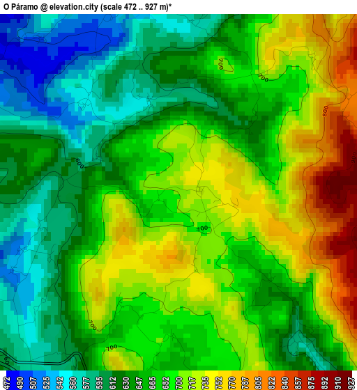
Below is the Elevation map of O Páramo, which displays elevation range with different colors. Scale of the first map is from 472 to 927 m (1549 to 3041 ft) with average elevation of 668 meters (=2192 ft) [note 1]
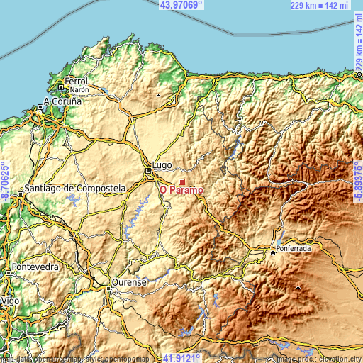
These maps also provides idea of topography and contour of this city, they are displayed at different zoom levels. More info about maps, scale and edge coordinates you can find below images.
| \ | Map #1 | Topo.Map |
| Scale [m] | 472..927 m | × |
| Scale [ft] | 1549..3041 ft | × |
| Average | 668 m = 2192 ft | × |
| Width | 7.15 km = 4.4 mi | 228.9 km = 142.2 mi |
| Height | 7.15 km = 4.4 mi | 228.9 km = 142.2 mi |
| ↑Max Latitude | 42.982157° | 43.97069° |
| Latitude at center | 42.95° | 42.95° |
| ↓Min Latitude | 42.917826° | 41.9121° |
| ← Min Longitude | -7.343945° | -8.70625° |
| Longitude center | -7.3° | -7.3° |
| →Max Longitude | -7.256055° | -5.89375° |
Nearby cities:
Cities around O Páramo sort by population:
• Lugo elevation 465 m
21.9 km,  287°
287°
• Sarria 422 m
20.9 km,  206°
206°
• Outeiro 553 m
21.6 km,  1°
1°
• Corgo 441 m
10.7 km,  266°
266°
• Becerreá 634 m
15.2 km,  133°
133°
• Castroverde 580 m
9.1 km,  347°
347°
• Baralla 484 m
7.4 km,  150°
150°
• Láncara 452 m
10 km,  197°
197°
• San Román 665 m
21.3 km,  114°
114°
• Samos 532 m
24.4 km,  184°
184°
• Navia de Suarna 292 m
24.5 km,  85°
85°
• Pol 506 m
22.3 km, 353°
Multilingual:
 En español:
O Páramo elevación 704 m.
 En France:
O Páramo élévation 704 m.
 Auf Deutsch:
O Páramo höhe über dem Meeresspiegel ist 704 m.

Sources and notes:
- [note 1] Map square and city borders are not equal. Map elevation data is calculated only from area inside that square.
- [src 1] Elevation data from geonames database provided with same terms of usage.
- [src 2] The elevation map of O Páramo is generated using elevation data from NASA's 3 arcsec (90m) resolution SRTM data.
- [src 3] Base (background) map © OpenStreetMap contributors tiles are generated by Geofabrik and OpenTopoMap.
Copyright & License:
This O Páramo Elevation Map is licensed under CC BY-SA. You may reuse any part from this page, if you give a proper credit by linking to this URL:
 More info on terms of use page.