Ríotorto elevation
Ríotorto (Galicia, Provincia de Lugo), Spain elevation is 163 meters and Ríotorto elevation in feet is 535 ft above sea level [src 1]. Ríotorto is a populated place (feature code) with elevation that is 440 meters (1444 ft) smaller than average city elevation in Spain.
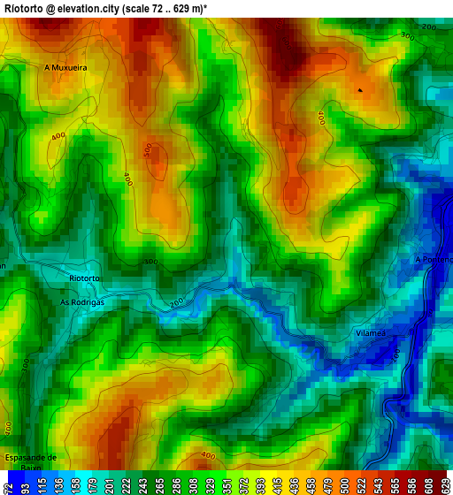
Below is the Elevation map of Ríotorto, which displays elevation range with different colors. Scale of the first map is from 72 to 629 m (236 to 2064 ft) with average elevation of 318.9 meters (=1046 ft) [note 1]
These maps also provides idea of topography and contour of this city, they are displayed at different zoom levels. More info about maps, scale and edge coordinates you can find below images.
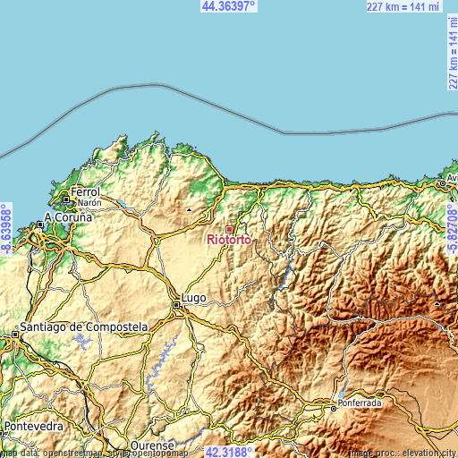
| \ | Map #1 | Topo.Map |
| Scale [m] | 72..629 m | × |
| Scale [ft] | 236..2064 ft | × |
| Average | 318.9 m = 1046 ft | × |
| Width | 7.11 km = 4.4 mi | 227.4 km = 141.3 mi |
| Height | 7.11 km = 4.4 mi | 227.4 km = 141.3 mi |
| ↑Max Latitude | 43.381947° | 44.36397° |
| Latitude at center | 43.35° | 43.35° |
| ↓Min Latitude | 43.318036° | 42.3188° |
| ← Min Longitude | -7.277275° | -8.63958° |
| Longitude center | -7.23333° | -7.23333° |
| →Max Longitude | -7.189385° | -5.82708° |
Nearby cities:
Cities around Ríotorto sort by population:
• Mondoñedo elevation 544 m
14.6 km,  292°
292°
• Mondoñedo 113 m
13.2 km,  310°
310°
• Vegadeo 9 m
19.6 km,  47°
47°
• Puente Nuevo 117 m
3.1 km,  91°
91°
• Abadín 474 m
20.3 km,  275°
275°
• Meira 483 m
16 km,  197°
197°
• Trabada 195 m
11 km,  16°
16°
• Taramundi 251 m
10.2 km,  83°
83°
• Santa Eulalia de Oscos 558 m
20.1 km,  120°
120°
• Villanueva de Oscos 646 m
20.4 km,  102°
102°
• Barreiros 194 m
20.4 km,  359°
359°
• San Tirso de Abres 42 m
9.8 km, 48°
Multilingual:
 En español:
Ríotorto elevación 163 m.
 En France:
Ríotorto élévation 163 m.
 Auf Deutsch:
Ríotorto höhe über dem Meeresspiegel ist 163 m.

Sources and notes:
- [note 1] Map square and city borders are not equal. Map elevation data is calculated only from area inside that square.
- [src 1] Elevation data from geonames database provided with same terms of usage.
- [src 2] The elevation map of Ríotorto is generated using elevation data from NASA's 3 arcsec (90m) resolution SRTM data.
- [src 3] Base (background) map © OpenStreetMap contributors tiles are generated by Geofabrik and OpenTopoMap.
Copyright & License:
This Ríotorto Elevation Map is licensed under CC BY-SA. You may reuse any part from this page, if you give a proper credit by linking to this URL:
 More info on terms of use page.