Vegadeo elevation
Vegadeo (Asturias, Province of Asturias), Spain elevation is 9 meters and Vegadeo elevation in feet is 30 ft above sea level [src 1]. Vegadeo is a seat of a third-order administrative division (feature code) with elevation that is 594 meters (1949 ft) smaller than average city elevation in Spain.
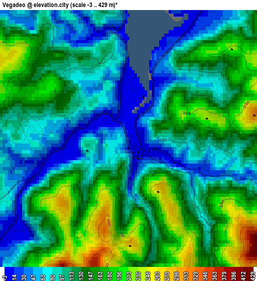
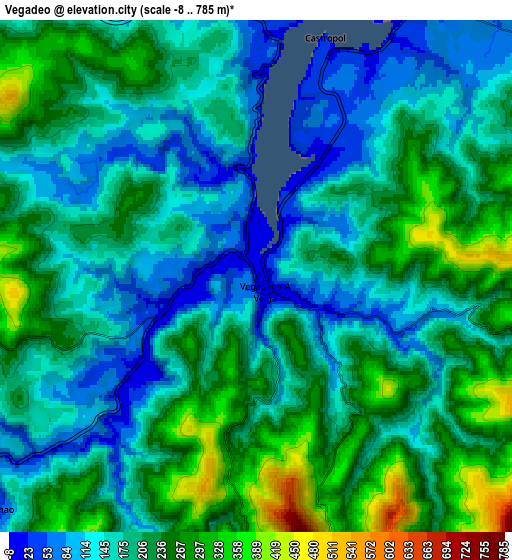
Below is the Elevation map of Vegadeo, which displays elevation range with different colors. Scale of the first map is from -3 to 429 m (-10 to 1407 ft) with average elevation of 122.8 meters (=403 ft) [note 1]
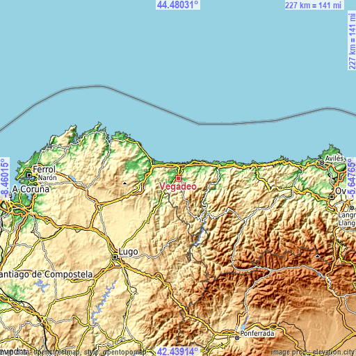
These maps also provides idea of topography and contour of this city, they are displayed at different zoom levels. More info about maps, scale and edge coordinates you can find below images.
| \ | Map #1 | Map #2 | Topo.Map |
| Scale [m] | -3..429 m | -8..785 m | × |
| Scale [ft] | -10..1407 ft | -26..2575 ft | × |
| Average | 122.8 m = 403 ft | 194.5 m = 638 ft | × |
| Width | 7.09 km = 4.4 mi | 14.18 km = 8.8 mi | 227 km = 141.1 mi |
| Height | 7.09 km = 4.4 mi | 14.18 km = 8.8 mi | 226.9 km = 141 mi |
| ↑Max Latitude | 43.500225° | 43.532093° | 44.48031° |
| Latitude at center | 43.46834° | 43.46834° | 43.46834° |
| ↓Min Latitude | 43.436438° | 43.404519° | 42.43914° |
| ← Min Longitude | -7.097845° | -7.141791° | -8.46015° |
| Longitude center | -7.0539° | -7.0539° | -7.0539° |
| →Max Longitude | -7.009955° | -6.966009° | -5.64765° |
Nearby cities:
Cities around Vegadeo sort by population:
• Ribadeo elevation 45 m
7.7 km,  7°
7°
• Tapia de Casariego 24 m
14.4 km,  38°
38°
• El Franco 54 m
18 km,  57°
57°
• Puente Nuevo 117 m
17.4 km,  220°
220°
• Boal 412 m
19.7 km,  101°
101°
• Ríotorto 163 m
19.6 km,  227°
227°
• Trabada 195 m
11.7 km,  257°
257°
• Taramundi 251 m
12.8 km,  200°
200°
• Villanueva de Oscos 646 m
18.3 km,  162°
162°
• Barreiros 194 m
16.2 km,  296°
296°
• San Tirso de Abres 42 m
9.8 km, 227°
• Castropol 27 m
6.9 km,  15°
15°
Multilingual:
 En español:
Vegadeo elevación 9 m.
 En France:
Vegadeo élévation 9 m.


Sources and notes:
- [note 1] Map square and city borders are not equal. Map elevation data is calculated only from area inside that square.
- [src 1] Elevation data from geonames database provided with same terms of usage.
- [src 2] The elevation map of Vegadeo is generated using elevation data from NASA's 3 arcsec (90m) resolution SRTM data.
- [src 3] Base (background) map © OpenStreetMap contributors tiles are generated by Geofabrik and OpenTopoMap.
Copyright & License:
This Vegadeo Elevation Map is licensed under CC BY-SA. You may reuse any part from this page, if you give a proper credit by linking to this URL:
 More info on terms of use page.