Salt elevation
Salt (Catalonia, Província de Girona), Spain elevation is 86 meters and Salt elevation in feet is 282 ft above sea level [src 1]. Salt is a seat of a third-order administrative division (feature code) with elevation that is 517 meters (1696 ft) smaller than average city elevation in Spain.
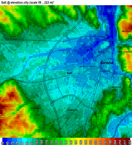
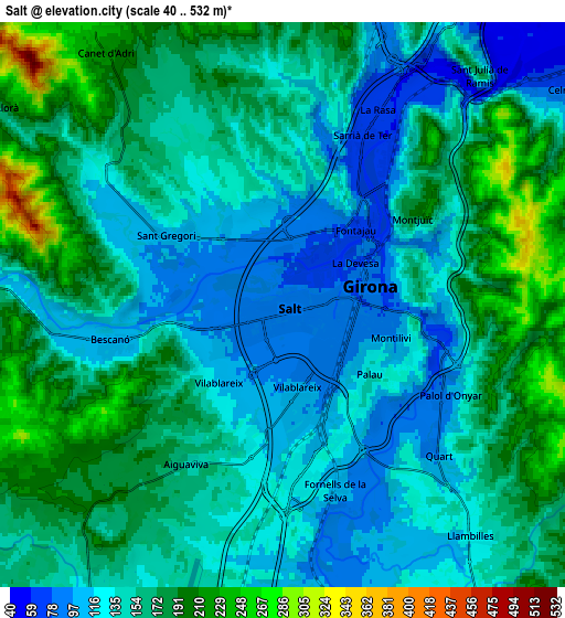
Below is the Elevation map of Salt, which displays elevation range with different colors. Scale of the first map is from 59 to 223 m (194 to 732 ft) with average elevation of 106.9 meters (=351 ft) [note 1]
These maps also provides idea of topography and contour of this city, they are displayed at different zoom levels. More info about maps, scale and edge coordinates you can find below images.
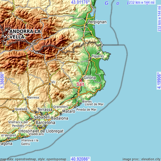
| \ | Map #1 | Map #2 | Topo.Map |
| Scale [m] | 59..223 m | 40..532 m | × |
| Scale [ft] | 194..732 ft | 131..1745 ft | × |
| Average | 106.9 m = 351 ft | 152.7 m = 501 ft | × |
| Width | 7.27 km = 4.5 mi | 14.53 km = 9 mi | 232.5 km = 144.5 mi |
| Height | 7.27 km = 4.5 mi | 14.53 km = 9 mi | 232.5 km = 144.5 mi |
| ↑Max Latitude | 42.007552° | 42.040198° | 43.01176° |
| Latitude at center | 41.97489° | 41.97489° | 41.97489° |
| ↓Min Latitude | 41.942211° | 41.909515° | 40.92086° |
| ← Min Longitude | 2.748865° | 2.704919° | 1.38656° |
| Longitude center | 2.79281° | 2.79281° | 2.79281° |
| →Max Longitude | 2.836755° | 2.880701° | 4.19906° |
Nearby cities:
Cities around Salt sort by population:
• Girona elevation 81 m
2.8 km,  71°
71°
• Sarrià de Ter 146 m
5.7 km,  35°
35°
• Bescanó 106 m
4.5 km,  257°
257°
• Celrà 54 m
9.9 km,  49°
49°
• Quart d’Onyar 96 m
5.5 km,  133°
133°
• Vilablareix 111 m
2.5 km,  219°
219°
• Fornells de la Selva 105 m
5 km,  164°
164°
• Riudellots de la Selva 100 m
9.1 km,  173°
173°
• Aiguaviva 158 m
4.8 km,  211°
211°
• Sant Julià de Ramis 165 m
7.9 km, 39°
• Llambilles 124 m
7.7 km,  141°
141°
• Sant Gregori 207 m
5 km,  280°
280°
Multilingual:
 En español:
Salt elevación 86 m.
 En France:
Salt élévation 86 m.


Sources and notes:
- [note 1] Map square and city borders are not equal. Map elevation data is calculated only from area inside that square.
- [src 1] Elevation data from geonames database provided with same terms of usage.
- [src 2] The elevation map of Salt is generated using elevation data from NASA's 3 arcsec (90m) resolution SRTM data.
- [src 3] Base (background) map © OpenStreetMap contributors tiles are generated by Geofabrik and OpenTopoMap.
Copyright & License:
This Salt Elevation Map is licensed under CC BY-SA. You may reuse any part from this page, if you give a proper credit by linking to this URL:
 More info on terms of use page.