Celrà elevation
Celrà (Catalonia, Província de Girona), Spain elevation is 54 meters and Celrà elevation in feet is 177 ft above sea level [src 1]. Celrà is a seat of a third-order administrative division (feature code) with elevation that is 549 meters (1801 ft) smaller than average city elevation in Spain.
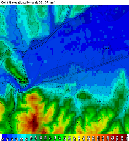
Below is the Elevation map of Celrà, which displays elevation range with different colors. Scale of the first map is from 30 to 371 m (98 to 1217 ft) with average elevation of 100.4 meters (=329 ft) [note 1]
These maps also provides idea of topography and contour of this city, they are displayed at different zoom levels. More info about maps, scale and edge coordinates you can find below images.
| \ | Map #1 | Topo.Map |
| Scale [m] | 30..371 m | × |
| Scale [ft] | 98..1217 ft | × |
| Average | 100.4 m = 329 ft | × |
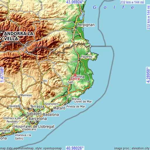
| Width | 7.26 km = 4.5 mi | 232.3 km = 144.3 mi |
| Height | 7.26 km = 4.5 mi | 232.3 km = 144.3 mi |
| ↑Max Latitude | 42.065962° | 43.06924° |
| Latitude at center | 42.03333° | 42.03333° |
| ↓Min Latitude | 42.000681° | 40.98026° |
| ← Min Longitude | 2.839385° | 1.47708° |
| Longitude center | 2.88333° | 2.88333° |
| →Max Longitude | 2.927275° | 4.28958° |
Nearby cities:
Cities around Celrà sort by population:
• Girona elevation 81 m
7.4 km,  220°
220°
• Sarrià de Ter 146 m
4.5 km,  245°
245°
• Bordils 45 m
2.5 km,  63°
63°
• Cervià de Ter 45 m
4.2 km,  28°
28°
• Palol de Revardit 144 m
7.8 km,  298°
298°
• Flaçà 44 m
7.8 km, 61°
• Viladasens 60 m
6.9 km,  36°
36°
• Sant Jordi Desvalls 30 m
6.6 km, 56°
• Sant Joan de Mollet 31 m
5.8 km,  71°
71°
• Sant Martí Vell 115 m
4.5 km,  114°
114°
• Juià 134 m
3.3 km,  123°
123°
• Sant Julià de Ramis 165 m
2.5 km,  259°
259°
Multilingual:
 En español:
Celrá elevación 54 m.
 En France:
Celrà élévation 54 m.


Sources and notes:
- [note 1] Map square and city borders are not equal. Map elevation data is calculated only from area inside that square.
- [src 1] Elevation data from geonames database provided with same terms of usage.
- [src 2] The elevation map of Celrà is generated using elevation data from NASA's 3 arcsec (90m) resolution SRTM data.
- [src 3] Base (background) map © OpenStreetMap contributors tiles are generated by Geofabrik and OpenTopoMap.
Copyright & License:
This Celrà Elevation Map is licensed under CC BY-SA. You may reuse any part from this page, if you give a proper credit by linking to this URL:
 More info on terms of use page.