Sarrià de Ter elevation
Sarrià de Ter (Catalonia, Província de Girona), Spain elevation is 146 meters and Sarrià de Ter elevation in feet is 479 ft above sea level [src 1]. Sarrià de Ter is a seat of a third-order administrative division (feature code) with elevation that is 457 meters (1499 ft) smaller than average city elevation in Spain.
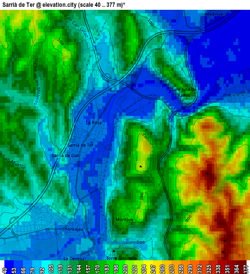
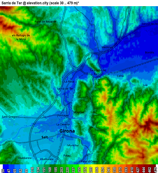
Below is the Elevation map of Sarrià de Ter, which displays elevation range with different colors. Scale of the first map is from 40 to 377 m (131 to 1237 ft) with average elevation of 134.9 meters (=443 ft) [note 1]
These maps also provides idea of topography and contour of this city, they are displayed at different zoom levels. More info about maps, scale and edge coordinates you can find below images.
| \ | Map #1 | Map #2 | Topo.Map |
| Scale [m] | 40..377 m | 30..479 m | × |
| Scale [ft] | 131..1237 ft | 98..1572 ft | × |
| Average | 134.9 m = 443 ft | 153.2 m = 503 ft | × |
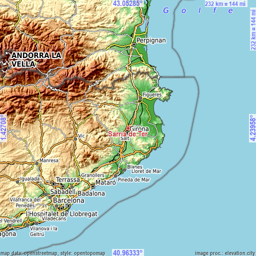
| Width | 7.26 km = 4.5 mi | 14.52 km = 9 mi | 232.3 km = 144.3 mi |
| Height | 7.26 km = 4.5 mi | 14.52 km = 9 mi | 232.3 km = 144.3 mi |
| ↑Max Latitude | 42.049311° | 42.081935° | 43.05285° |
| Latitude at center | 42.01667° | 42.01667° | 42.01667° |
| ↓Min Latitude | 41.984012° | 41.951338° | 40.96333° |
| ← Min Longitude | 2.789385° | 2.745439° | 1.42708° |
| Longitude center | 2.83333° | 2.83333° | 2.83333° |
| →Max Longitude | 2.877275° | 2.921221° | 4.23958° |
Nearby cities:
Cities around Sarrià de Ter sort by population:
• Girona elevation 81 m
3.8 km,  190°
190°
• Salt 86 m
5.7 km,  215°
215°
• Celrà 54 m
4.5 km,  65°
65°
• Quart d’Onyar 96 m
8.5 km,  175°
175°
• Vilablareix 111 m
8.2 km, 216°
• Bordils 45 m
7.1 km, 65°
• Cervià de Ter 45 m
8.3 km,  47°
47°
• Sant Martí Vell 115 m
8.3 km,  90°
90°
• Cornellà del Terri 102 m
7.5 km,  349°
349°
• Juià 134 m
6.9 km, 90°
• Palol de Revardit 144 m
6.2 km,  333°
333°
• Sant Julià de Ramis 165 m
2.2 km, 49°
Multilingual:
 En español:
Sarriá de Ter elevación 146 m.
 En France:
Sarrià de Ter élévation 146 m.
 Auf Deutsch:
Sarrià de Ter höhe über dem Meeresspiegel ist 146 m.

Sources and notes:
- [note 1] Map square and city borders are not equal. Map elevation data is calculated only from area inside that square.
- [src 1] Elevation data from geonames database provided with same terms of usage.
- [src 2] The elevation map of Sarrià de Ter is generated using elevation data from NASA's 3 arcsec (90m) resolution SRTM data.
- [src 3] Base (background) map © OpenStreetMap contributors tiles are generated by Geofabrik and OpenTopoMap.
Copyright & License:
This Sarrià de Ter Elevation Map is licensed under CC BY-SA. You may reuse any part from this page, if you give a proper credit by linking to this URL:
 More info on terms of use page.