Bescanó elevation
Bescanó (Catalonia, Província de Girona), Spain elevation is 106 meters and Bescanó elevation in feet is 348 ft above sea level [src 1]. Bescanó is a seat of a third-order administrative division (feature code) with elevation that is 497 meters (1631 ft) smaller than average city elevation in Spain.
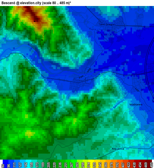
Below is the Elevation map of Bescanó, which displays elevation range with different colors. Scale of the first map is from 80 to 485 m (262 to 1591 ft) with average elevation of 168.6 meters (=553 ft) [note 1]
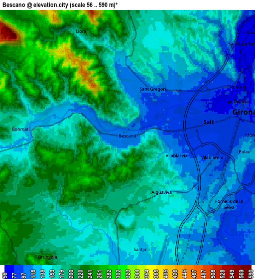
These maps also provides idea of topography and contour of this city, they are displayed at different zoom levels. More info about maps, scale and edge coordinates you can find below images.
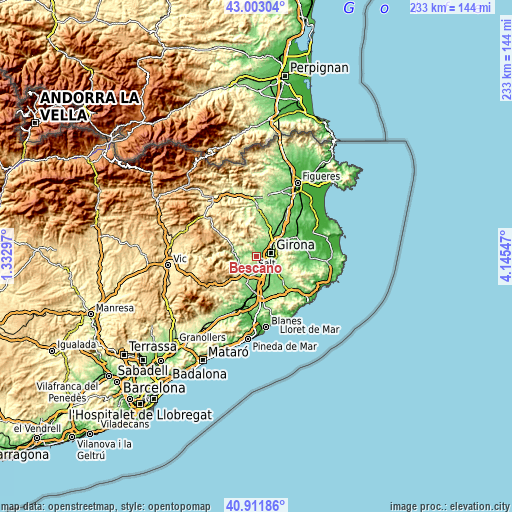
| \ | Map #1 | Map #2 | Topo.Map |
| Scale [m] | 80..485 m | 56..590 m | × |
| Scale [ft] | 262..1591 ft | 184..1936 ft | × |
| Average | 168.6 m = 553 ft | 169.4 m = 556 ft | × |
| Width | 7.27 km = 4.5 mi | 14.53 km = 9 mi | 232.5 km = 144.5 mi |
| Height | 7.27 km = 4.5 mi | 14.53 km = 9 mi | 232.5 km = 144.5 mi |
| ↑Max Latitude | 41.998697° | 42.031347° | 43.00304° |
| Latitude at center | 41.96603° | 41.96603° | 41.96603° |
| ↓Min Latitude | 41.933346° | 41.900646° | 40.91186° |
| ← Min Longitude | 2.695275° | 2.651329° | 1.33297° |
| Longitude center | 2.73922° | 2.73922° | 2.73922° |
| →Max Longitude | 2.783165° | 2.827111° | 4.14547° |
Nearby cities:
Cities around Bescanó sort by population:
• Girona elevation 81 m
7.3 km,  74°
74°
• Salt 86 m
4.5 km,  77°
77°
• Anglès 163 m
8.6 km,  262°
262°
• Sarrià de Ter 146 m
9.6 km,  54°
54°
• Quart d’Onyar 96 m
8.9 km,  108°
108°
• Vilablareix 111 m
3 km, 108°
• Fornells de la Selva 105 m
6.9 km,  123°
123°
• Aiguaviva 158 m
3.6 km,  148°
148°
• la Cellera de Ter 157 m
9.5 km,  272°
272°
• Vilobí d'Onyar 114 m
9.2 km,  174°
174°
• Brunyola 265 m
8.7 km,  212°
212°
• Sant Gregori 207 m
2 km,  345°
345°
Multilingual:
 En español:
Bescanó elevación 106 m.
 En France:
Bescanó élévation 106 m.


Sources and notes:
- [note 1] Map square and city borders are not equal. Map elevation data is calculated only from area inside that square.
- [src 1] Elevation data from geonames database provided with same terms of usage.
- [src 2] The elevation map of Bescanó is generated using elevation data from NASA's 3 arcsec (90m) resolution SRTM data.
- [src 3] Base (background) map © OpenStreetMap contributors tiles are generated by Geofabrik and OpenTopoMap.
Copyright & License:
This Bescanó Elevation Map is licensed under CC BY-SA. You may reuse any part from this page, if you give a proper credit by linking to this URL:
 More info on terms of use page.