Tafalla elevation
Tafalla (Navarre, Provincia de Navarra), Spain elevation is 424 meters and Tafalla elevation in feet is 1391 ft above sea level [src 1]. Tafalla is a seat of a third-order administrative division (feature code) with elevation that is 179 meters (587 ft) smaller than average city elevation in Spain.
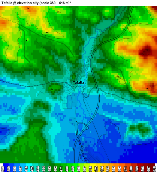
Below is the Elevation map of Tafalla, which displays elevation range with different colors. Scale of the first map is from 380 to 616 m (1247 to 2021 ft) with average elevation of 452.9 meters (=1486 ft) [note 1]
These maps also provides idea of topography and contour of this city, they are displayed at different zoom levels. More info about maps, scale and edge coordinates you can find below images.
| \ | Map #1 | Map #2 | Topo.Map |
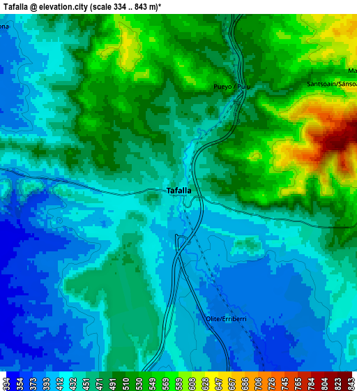
| Scale [m] | 380..616 m | 334..843 m | × |
| Scale [ft] | 1247..2021 ft | 1096..2766 ft | × |
| Average | 452.9 m = 1486 ft | 463.8 m = 1522 ft | × |
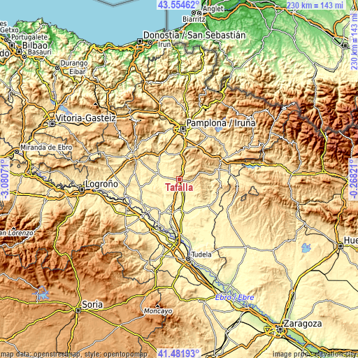
| Width | 7.2 km = 4.5 mi | 14.4 km = 8.9 mi | 230.5 km = 143.2 mi |
| Height | 7.2 km = 4.5 mi | 14.4 km = 8.9 mi | 230.5 km = 143.2 mi |
| ↑Max Latitude | 42.559248° | 42.591608° | 43.55462° |
| Latitude at center | 42.52687° | 42.52687° | 42.52687° |
| ↓Min Latitude | 42.494476° | 42.462065° | 41.48193° |
| ← Min Longitude | -1.718405° | -1.762351° | -3.08071° |
| Longitude center | -1.67446° | -1.67446° | -1.67446° |
| →Max Longitude | -1.630515° | -1.586569° | -0.26821° |
Nearby cities:
Cities around Tafalla sort by population:
• Olite elevation 394 m
5.6 km,  160°
160°
• Artajona 410 m
10.1 km,  312°
312°
• Miranda de Arga 317 m
13.5 km,  248°
248°
• Berbinzana 320 m
13.1 km,  270°
270°
• Pitillas 347 m
12.5 km, 159°
• Barásoain 530 m
8.8 km,  15°
15°
• Garínoain 534 m
8.5 km, 16°
• San Martín de Unx 613 m
9.3 km,  91°
91°
• Pueyo 533 m
4.8 km,  26°
26°
• Beire 371 m
9.2 km,  151°
151°
• Olóriz 599 m
13.1 km, 22°
• Orísoain 582 m
10.1 km, 34°
Multilingual:
 En español:
Tafalla elevación 424 m.
 En France:
Tafalla élévation 424 m.


Sources and notes:
- [note 1] Map square and city borders are not equal. Map elevation data is calculated only from area inside that square.
- [src 1] Elevation data from geonames database provided with same terms of usage.
- [src 2] The elevation map of Tafalla is generated using elevation data from NASA's 3 arcsec (90m) resolution SRTM data.
- [src 3] Base (background) map © OpenStreetMap contributors tiles are generated by Geofabrik and OpenTopoMap.
Copyright & License:
This Tafalla Elevation Map is licensed under CC BY-SA. You may reuse any part from this page, if you give a proper credit by linking to this URL:
 More info on terms of use page.