Villanúa elevation
Villanúa (Aragon, Provincia de Huesca), Spain elevation is 959 meters and Villanúa elevation in feet is 3146 ft above sea level [src 1]. Villanúa is a seat of a third-order administrative division (feature code) with elevation that is 356 meters (1168 ft) bigger than average city elevation in Spain.
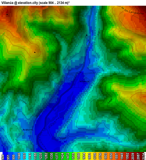
Below is the Elevation map of Villanúa, which displays elevation range with different colors. Scale of the first map is from 904 to 2134 m (2966 to 7001 ft) with average elevation of 1309.2 meters (=4295 ft) [note 1]
These maps also provides idea of topography and contour of this city, they are displayed at different zoom levels. More info about maps, scale and edge coordinates you can find below images.
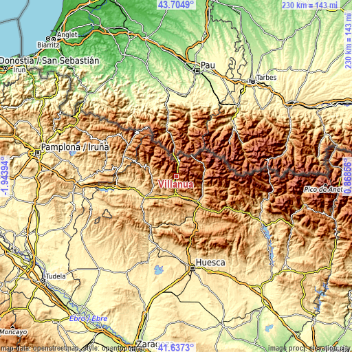
| \ | Map #1 | Topo.Map |
| Scale [m] | 904..2134 m | × |
| Scale [ft] | 2966..7001 ft | × |
| Average | 1309.2 m = 4295 ft | × |
| Width | 7.18 km = 4.5 mi | 229.9 km = 142.9 mi |
| Height | 7.18 km = 4.5 mi | 229.9 km = 142.9 mi |
| ↑Max Latitude | 42.711998° | 43.7049° |
| Latitude at center | 42.6797° | 42.6797° |
| ↓Min Latitude | 42.647385° | 41.6373° |
| ← Min Longitude | -0.581635° | -1.94394° |
| Longitude center | -0.53769° | -0.53769° |
| →Max Longitude | -0.493745° | 0.86856° |
Nearby cities:
Cities around Villanúa sort by population:
• Jaca elevation 827 m
12.4 km,  184°
184°
• Sabiñánigo 807 m
22.7 km,  141°
141°
• Sallent de Gállego 1289 m
19.5 km,  58°
58°
• Echo 821 m
18.5 km,  290°
290°
• Canfranc 1056 m
4.2 km,  13°
13°
• Castiello de Jaca 899 m
5.7 km,  190°
190°
• Santa Cruz de la Serós 801 m
20.8 km,  212°
212°
• Aragüés del Puerto 948 m
11.2 km, 285°
• Jasa 945 m
10.6 km,  279°
279°
• Hoz de Jaca 1267 m
18.9 km,  86°
86°
• Borau 991 m
4.8 km,  240°
240°
• Biescas 860 m
18.6 km,  107°
107°
Multilingual:
 En español:
Villanúa elevación 959 m.
 En France:
Villanúa élévation 959 m.
 Auf Deutsch:
Villanúa höhe über dem Meeresspiegel ist 959 m.

Sources and notes:
- [note 1] Map square and city borders are not equal. Map elevation data is calculated only from area inside that square.
- [src 1] Elevation data from geonames database provided with same terms of usage.
- [src 2] The elevation map of Villanúa is generated using elevation data from NASA's 3 arcsec (90m) resolution SRTM data.
- [src 3] Base (background) map © OpenStreetMap contributors tiles are generated by Geofabrik and OpenTopoMap.
Copyright & License:
This Villanúa Elevation Map is licensed under CC BY-SA. You may reuse any part from this page, if you give a proper credit by linking to this URL:
 More info on terms of use page.