Castilblanco elevation
Castilblanco (Extremadura, Provincia de Badajoz), Spain elevation is 505 meters and Castilblanco elevation in feet is 1657 ft above sea level [src 1]. Castilblanco is a seat of a third-order administrative division (feature code) with elevation that is 98 meters (322 ft) smaller than average city elevation in Spain.
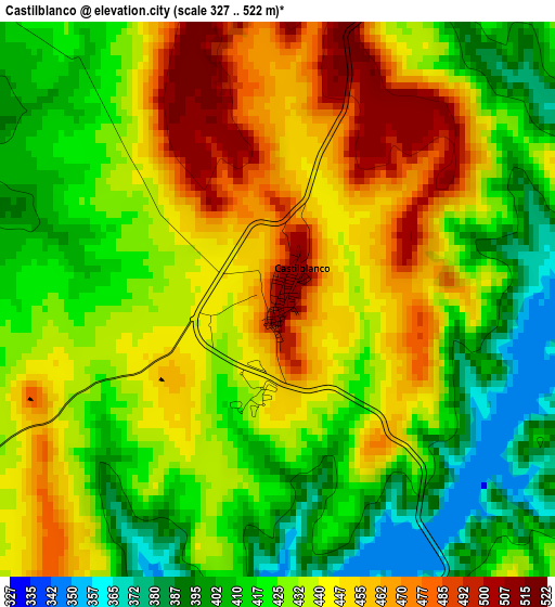
Below is the Elevation map of Castilblanco, which displays elevation range with different colors. Scale of the first map is from 327 to 522 m (1073 to 1713 ft) with average elevation of 432.7 meters (=1420 ft) [note 1]
These maps also provides idea of topography and contour of this city, they are displayed at different zoom levels. More info about maps, scale and edge coordinates you can find below images.
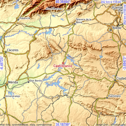
| \ | Map #1 | Topo.Map |
| Scale [m] | 327..522 m | × |
| Scale [ft] | 1073..1713 ft | × |
| Average | 432.7 m = 1420 ft | × |
| Width | 7.56 km = 4.7 mi | 242 km = 150.4 mi |
| Height | 7.56 km = 4.7 mi | 242 km = 150.4 mi |
| ↑Max Latitude | 39.318876° | 40.36484° |
| Latitude at center | 39.28487° | 39.28487° |
| ↓Min Latitude | 39.250848° | 38.18799° |
| ← Min Longitude | -5.134925° | -6.49723° |
| Longitude center | -5.09098° | -5.09098° |
| →Max Longitude | -5.047035° | -3.68473° |
Nearby cities:
Cities around Castilblanco sort by population:
• Herrera del Duque elevation 461 m
13.4 km,  164°
164°
• Talarrubias 440 m
30.2 km,  204°
204°
• Guadalupe 640 m
27.4 km,  312°
312°
• Fuenlabrada de los Montes 539 m
21.6 km,  141°
141°
• Casas de Don Pedro 376 m
28.5 km,  226°
226°
• Cañamero 609 m
27.7 km,  292°
292°
• Rosalejo 495 m
23.1 km,  42°
42°
• Valdecaballeros 406 m
9.7 km,  241°
241°
• Alía 576 m
21.2 km,  329°
329°
• Garbayuela 488 m
27.4 km, 163°
• Puerto de San Vicente 750 m
26.5 km,  355°
355°
• Villarta de los Montes 550 m
26.9 km,  107°
107°
Multilingual:
 En español:
Castilblanco elevación 505 m.
 En France:
Castilblanco élévation 505 m.
 Auf Deutsch:
Castilblanco höhe über dem Meeresspiegel ist 505 m.

Sources and notes:
- [note 1] Map square and city borders are not equal. Map elevation data is calculated only from area inside that square.
- [src 1] Elevation data from geonames database provided with same terms of usage.
- [src 2] The elevation map of Castilblanco is generated using elevation data from NASA's 3 arcsec (90m) resolution SRTM data.
- [src 3] Base (background) map © OpenStreetMap contributors tiles are generated by Geofabrik and OpenTopoMap.
Copyright & License:
This Castilblanco Elevation Map is licensed under CC BY-SA. You may reuse any part from this page, if you give a proper credit by linking to this URL:
 More info on terms of use page.