Moratalla elevation
Moratalla (Murcia), Spain elevation is 641 meters and Moratalla elevation in feet is 2103 ft above sea level [src 1]. Moratalla is a seat of a third-order administrative division (feature code) with elevation that is 38 meters (125 ft) bigger than average city elevation in Spain.
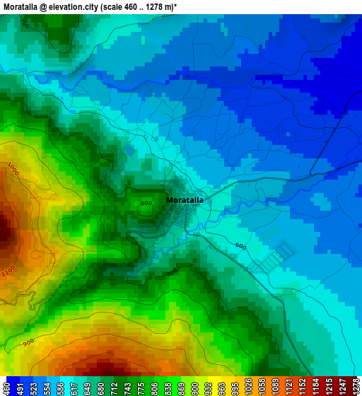
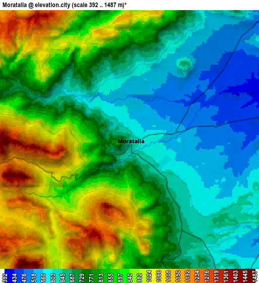
Below is the Elevation map of Moratalla, which displays elevation range with different colors. Scale of the first map is from 460 to 1278 m (1509 to 4193 ft) with average elevation of 690.9 meters (=2267 ft) [note 1]
These maps also provides idea of topography and contour of this city, they are displayed at different zoom levels. More info about maps, scale and edge coordinates you can find below images.
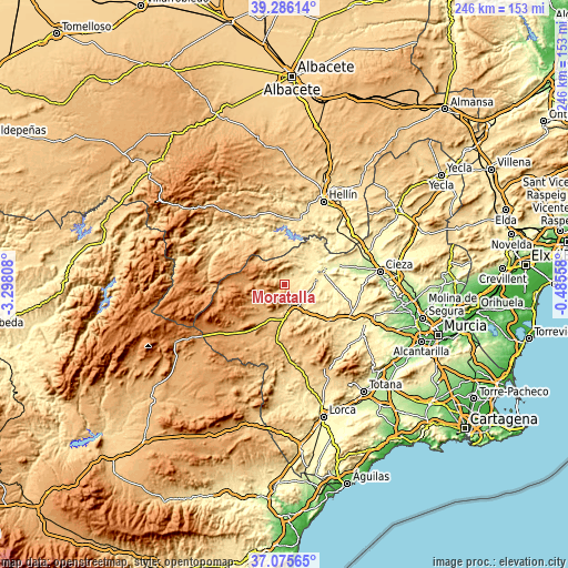
| \ | Map #1 | Map #2 | Topo.Map |
| Scale [m] | 460..1278 m | 392..1487 m | × |
| Scale [ft] | 1509..4193 ft | 1286..4879 ft | × |
| Average | 690.9 m = 2267 ft | 796.2 m = 2612 ft | × |
| Width | 7.68 km = 4.8 mi | 15.36 km = 9.5 mi | 245.8 km = 152.7 mi |
| Height | 7.68 km = 4.8 mi | 15.36 km = 9.5 mi | 245.8 km = 152.7 mi |
| ↑Max Latitude | 38.223812° | 38.258327° | 39.28614° |
| Latitude at center | 38.18928° | 38.18928° | 38.18928° |
| ↓Min Latitude | 38.154732° | 38.120168° | 37.07565° |
| ← Min Longitude | -1.935775° | -1.979721° | -3.29808° |
| Longitude center | -1.89183° | -1.89183° | -1.89183° |
| →Max Longitude | -1.847885° | -1.803939° | -0.48558° |
Nearby cities:
Cities around Moratalla sort by population:
• Hellín elevation 557 m
39.4 km,  24°
24°
• Caravaca 647 m
9.6 km,  165°
165°
• Mula 308 m
38.8 km,  115°
115°
• Cehegín 541 m
13.5 km,  142°
142°
• Bullas 654 m
24.9 km,  129°
129°
• Calasparra 355 m
17.4 km,  74°
74°
• Elche de la Sierra 642 m
32.1 km,  334°
334°
• Socovos 741 m
17.9 km, 332°
• Nerpio 1078 m
36.2 km,  262°
262°
• Liétor 672 m
39.7 km,  352°
352°
• Letur 735 m
26.9 km,  317°
317°
• Férez 677 m
20.2 km, 332°
Multilingual:
 En español:
Moratalla elevación 641 m.
 En France:
Moratalla élévation 641 m.
 Auf Deutsch:
Moratalla höhe über dem Meeresspiegel ist 641 m.

Sources and notes:
- [note 1] Map square and city borders are not equal. Map elevation data is calculated only from area inside that square.
- [src 1] Elevation data from geonames database provided with same terms of usage.
- [src 2] The elevation map of Moratalla is generated using elevation data from NASA's 3 arcsec (90m) resolution SRTM data.
- [src 3] Base (background) map © OpenStreetMap contributors tiles are generated by Geofabrik and OpenTopoMap.
Copyright & License:
This Moratalla Elevation Map is licensed under CC BY-SA. You may reuse any part from this page, if you give a proper credit by linking to this URL:
 More info on terms of use page.