Nogales elevation
Nogales (Extremadura, Provincia de Badajoz), Spain elevation is 373 meters and Nogales elevation in feet is 1224 ft above sea level [src 1]. Nogales is a seat of a third-order administrative division (feature code) with elevation that is 230 meters (755 ft) smaller than average city elevation in Spain.
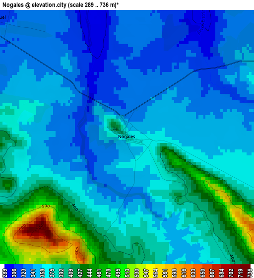
Below is the Elevation map of Nogales, which displays elevation range with different colors. Scale of the first map is from 289 to 736 m (948 to 2415 ft) with average elevation of 371.5 meters (=1219 ft) [note 1]
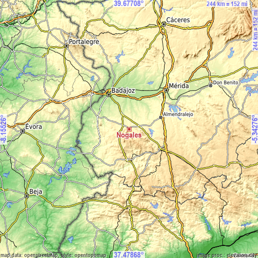
These maps also provides idea of topography and contour of this city, they are displayed at different zoom levels. More info about maps, scale and edge coordinates you can find below images.
| \ | Map #1 | Topo.Map |
| Scale [m] | 289..736 m | × |
| Scale [ft] | 948..2415 ft | × |
| Average | 371.5 m = 1219 ft | × |
| Width | 7.64 km = 4.7 mi | 244.4 km = 151.9 mi |
| Height | 7.64 km = 4.7 mi | 244.4 km = 151.9 mi |
| ↑Max Latitude | 38.620633° | 39.67708° |
| Latitude at center | 38.58629° | 38.58629° |
| ↓Min Latitude | 38.551931° | 37.47868° |
| ← Min Longitude | -6.792955° | -8.15526° |
| Longitude center | -6.74901° | -6.74901° |
| →Max Longitude | -6.705065° | -5.34276° |
Nearby cities:
Cities around Nogales sort by population:
• Santa Marta elevation 341 m
11 km,  73°
73°
• Barcarrota 489 m
11.8 km,  227°
227°
• Salvaleón 531 m
9.1 km,  200°
200°
• Salvatierra de los Barros 621 m
12 km,  152°
152°
• La Albuera 258 m
16 km,  336°
336°
• Villalba de los Barros 310 m
21.1 km,  81°
81°
• La Parra 519 m
13.2 km,  123°
123°
• Feria 551 m
18.1 km, 117°
• Almendral 325 m
7 km,  296°
296°
• Corte de Peleas 246 m
17 km,  23°
23°
• Torre de Miguel Sesmero 322 m
5.5 km,  311°
311°
• Entrín Bajo 244 m
15 km,  11°
11°
Multilingual:
 En español:
Nogales elevación 373 m.
 En France:
Nogales élévation 373 m.


Sources and notes:
- [note 1] Map square and city borders are not equal. Map elevation data is calculated only from area inside that square.
- [src 1] Elevation data from geonames database provided with same terms of usage.
- [src 2] The elevation map of Nogales is generated using elevation data from NASA's 3 arcsec (90m) resolution SRTM data.
- [src 3] Base (background) map © OpenStreetMap contributors tiles are generated by Geofabrik and OpenTopoMap.
Copyright & License:
This Nogales Elevation Map is licensed under CC BY-SA. You may reuse any part from this page, if you give a proper credit by linking to this URL:
 More info on terms of use page.