Barcarrota elevation
Barcarrota (Extremadura, Provincia de Badajoz), Spain elevation is 489 meters and Barcarrota elevation in feet is 1604 ft above sea level [src 1]. Barcarrota is a seat of a third-order administrative division (feature code) with elevation that is 114 meters (374 ft) smaller than average city elevation in Spain.
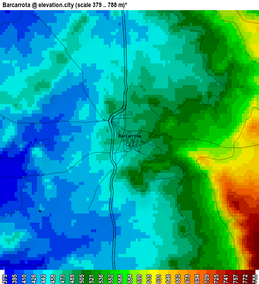
Below is the Elevation map of Barcarrota, which displays elevation range with different colors. Scale of the first map is from 379 to 788 m (1243 to 2585 ft) with average elevation of 483.3 meters (=1586 ft) [note 1]
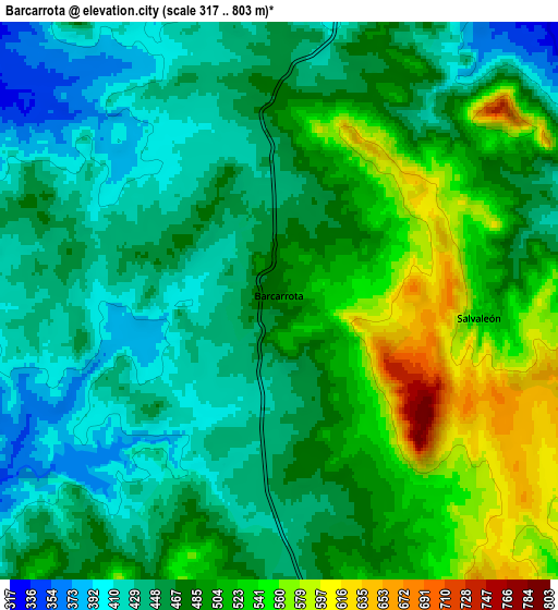
These maps also provides idea of topography and contour of this city, they are displayed at different zoom levels. More info about maps, scale and edge coordinates you can find below images.
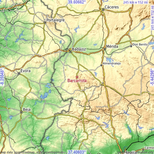
| \ | Map #1 | Map #2 | Topo.Map |
| Scale [m] | 379..788 m | 317..803 m | × |
| Scale [ft] | 1243..2585 ft | 1040..2635 ft | × |
| Average | 483.3 m = 1586 ft | 477.2 m = 1566 ft | × |
| Width | 7.65 km = 4.8 mi | 15.29 km = 9.5 mi | 244.7 km = 152 mi |
| Height | 7.65 km = 4.8 mi | 15.29 km = 9.5 mi | 244.7 km = 152 mi |
| ↑Max Latitude | 38.549107° | 38.583467° | 39.60662° |
| Latitude at center | 38.51473° | 38.51473° | 38.51473° |
| ↓Min Latitude | 38.480337° | 38.445927° | 37.40603° |
| ← Min Longitude | -6.893175° | -6.937121° | -8.25548° |
| Longitude center | -6.84923° | -6.84923° | -6.84923° |
| →Max Longitude | -6.805285° | -6.761339° | -5.44298° |
Nearby cities:
Cities around Barcarrota sort by population:
• Valverde de Leganés elevation 295 m
20.7 km,  326°
326°
• Salvaleón 531 m
5.5 km,  95°
95°
• Higuera de Vargas 358 m
13.3 km,  235°
235°
• Alconchel 283 m
19.3 km,  270°
270°
• Salvatierra de los Barros 621 m
14.6 km, 100°
• La Parra 519 m
19.7 km,  87°
87°
• Almendral 325 m
11.3 km,  12°
12°
• Valle de Santa Ana 503 m
17.3 km,  162°
162°
• Torre de Miguel Sesmero 322 m
12.5 km,  21°
21°
• Táliga 305 m
14.7 km,  276°
276°
• Nogales 373 m
11.8 km,  47°
47°
• Valle de Matamoros 602 m
15.6 km,  165°
165°
Multilingual:
 En español:
Barcarrota elevación 489 m.
 En France:
Barcarrota élévation 489 m.
 Auf Deutsch:
Barcarrota höhe über dem Meeresspiegel ist 489 m.

Sources and notes:
- [note 1] Map square and city borders are not equal. Map elevation data is calculated only from area inside that square.
- [src 1] Elevation data from geonames database provided with same terms of usage.
- [src 2] The elevation map of Barcarrota is generated using elevation data from NASA's 3 arcsec (90m) resolution SRTM data.
- [src 3] Base (background) map © OpenStreetMap contributors tiles are generated by Geofabrik and OpenTopoMap.
Copyright & License:
This Barcarrota Elevation Map is licensed under CC BY-SA. You may reuse any part from this page, if you give a proper credit by linking to this URL:
 More info on terms of use page.