Santisteban del Puerto elevation
Santisteban del Puerto (Andalusia, Provincia de Jaén), Spain elevation is 707 meters and Santisteban del Puerto elevation in feet is 2320 ft above sea level [src 1]. Santisteban del Puerto is a seat of a third-order administrative division (feature code) with elevation that is 104 meters (341 ft) bigger than average city elevation in Spain.
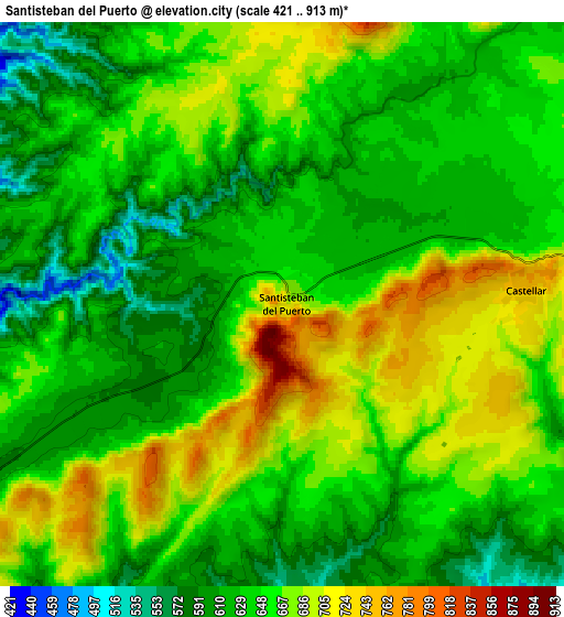
Below is the Elevation map of Santisteban del Puerto, which displays elevation range with different colors. Scale of the first map is from 501 to 913 m (1644 to 2995 ft) with average elevation of 664.8 meters (=2181 ft) [note 1]
These maps also provides idea of topography and contour of this city, they are displayed at different zoom levels. More info about maps, scale and edge coordinates you can find below images.

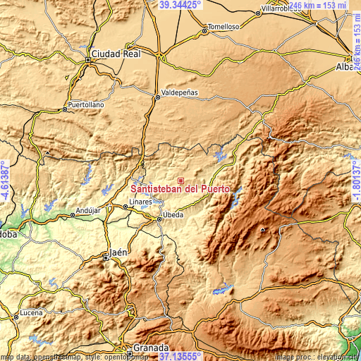
| \ | Map #1 | Map #2 | Topo.Map |
| Scale [m] | 501..913 m | 421..913 m | × |
| Scale [ft] | 1644..2995 ft | 1381..2995 ft | × |
| Average | 664.8 m = 2181 ft | 648.9 m = 2129 ft | × |
| Width | 7.67 km = 4.8 mi | 15.35 km = 9.5 mi | 245.6 km = 152.6 mi |
| Height | 7.67 km = 4.8 mi | 15.35 km = 9.5 mi | 245.6 km = 152.6 mi |
| ↑Max Latitude | 38.282794° | 38.317281° | 39.34425° |
| Latitude at center | 38.24829° | 38.24829° | 38.24829° |
| ↓Min Latitude | 38.21377° | 38.179234° | 37.13555° |
| ← Min Longitude | -3.251565° | -3.295511° | -4.61387° |
| Longitude center | -3.20762° | -3.20762° | -3.20762° |
| →Max Longitude | -3.163675° | -3.119729° | -1.80137° |
Nearby cities:
Cities around Santisteban del Puerto sort by population:
• Campiña elevation 641 m
20.1 km,  99°
99°
• Villacarrillo 799 m
18.2 km,  143°
143°
• Villanueva del Arzobispo 683 m
19.6 km,  116°
116°
• Navas de San Juan 657 m
11.9 km,  232°
232°
• Sabiote 829 m
22 km,  205°
205°
• Castellar de Santisteban 763 m
6.7 km,  84°
84°
• Montizón 643 m
13.8 km,  40°
40°
• Arquillos 392 m
20.7 km,  248°
248°
• Chiclana de Segura 863 m
16.1 km,  63°
63°
• Sorihuela del Guadalimar 650 m
13.5 km,  93°
93°
• Iznatoraf 1031 m
18.4 km, 123°
• Aldeaquemada 701 m
23.2 km,  321°
321°
Multilingual:
 En español:
Santisteban del Puerto elevación 707 m.
 En France:
Santisteban del Puerto élévation 707 m.
 Auf Deutsch:
Santisteban del Puerto höhe über dem Meeresspiegel ist 707 m.
 На русском:
Santisteban del Puerto высота над уровнем моря 707 м
Sources and notes:
- [note 1] Map square and city borders are not equal. Map elevation data is calculated only from area inside that square.
- [src 1] Elevation data from geonames database provided with same terms of usage.
- [src 2] The elevation map of Santisteban del Puerto is generated using elevation data from NASA's 3 arcsec (90m) resolution SRTM data.
- [src 3] Base (background) map © OpenStreetMap contributors tiles are generated by Geofabrik and OpenTopoMap.
Copyright & License:
This Santisteban del Puerto Elevation Map is licensed under CC BY-SA. You may reuse any part from this page, if you give a proper credit by linking to this URL:
 More info on terms of use page.