Campiña elevation
Campiña (Andalusia, Provincia de Jaén), Spain elevation is 641 meters and Campiña elevation in feet is 2103 ft above sea level [src 1]. Campiña is a populated place (feature code) with elevation that is 38 meters (125 ft) bigger than average city elevation in Spain.
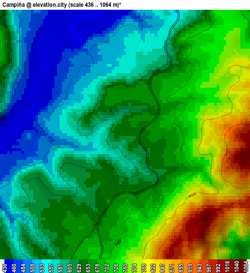
Below is the Elevation map of Campiña, which displays elevation range with different colors. Scale of the first map is from 436 to 1064 m (1430 to 3491 ft) with average elevation of 648.8 meters (=2129 ft) [note 1]
These maps also provides idea of topography and contour of this city, they are displayed at different zoom levels. More info about maps, scale and edge coordinates you can find below images.
| \ | Map #1 | Map #2 | Topo.Map |
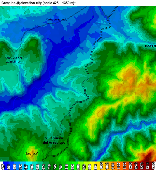
| Scale [m] | 436..1064 m | 425..1350 m | × |
| Scale [ft] | 1430..3491 ft | 1394..4429 ft | × |
| Average | 648.8 m = 2129 ft | 668 m = 2192 ft | × |
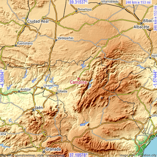
| Width | 7.68 km = 4.8 mi | 15.36 km = 9.5 mi | 245.7 km = 152.7 mi |
| Height | 7.68 km = 4.8 mi | 15.36 km = 9.5 mi | 245.7 km = 152.7 mi |
| ↑Max Latitude | 38.253478° | 38.287979° | 39.31537° |
| Latitude at center | 38.21896° | 38.21896° | 38.21896° |
| ↓Min Latitude | 38.184426° | 38.149876° | 37.10578° |
| ← Min Longitude | -3.024635° | -3.068581° | -4.38694° |
| Longitude center | -2.98069° | -2.98069° | -2.98069° |
| →Max Longitude | -2.936745° | -2.892799° | -1.57444° |
Nearby cities:
Cities around Campiña sort by population:
• Villacarrillo elevation 799 m
14.7 km,  218°
218°
• Villanueva del Arzobispo 683 m
6.1 km,  202°
202°
• Beas de Segura 586 m
8.8 km,  65°
65°
• Santisteban del Puerto 707 m
20.1 km,  279°
279°
• Castellar de Santisteban 763 m
13.8 km,  286°
286°
• Arroyo del Ojanco 541 m
13.6 km,  33°
33°
• Santo Tomé 454 m
23.6 km,  206°
206°
• Puente de Génave 544 m
21.7 km,  45°
45°
• Montizón 643 m
17.5 km,  321°
321°
• Chiclana de Segura 863 m
11.6 km,  332°
332°
• Sorihuela del Guadalimar 650 m
6.8 km, 290°
• Iznatoraf 1031 m
8.2 km, 213°
Multilingual:
 En español:
Campiña elevación 641 m.
 En France:
Campiña élévation 641 m.


Sources and notes:
- [note 1] Map square and city borders are not equal. Map elevation data is calculated only from area inside that square.
- [src 1] Elevation data from geonames database provided with same terms of usage.
- [src 2] The elevation map of Campiña is generated using elevation data from NASA's 3 arcsec (90m) resolution SRTM data.
- [src 3] Base (background) map © OpenStreetMap contributors tiles are generated by Geofabrik and OpenTopoMap.
Copyright & License:
This Campiña Elevation Map is licensed under CC BY-SA. You may reuse any part from this page, if you give a proper credit by linking to this URL:
 More info on terms of use page.