Aerzen elevation
Aerzen (Lower Saxony), Germany elevation is 105 meters and Aerzen elevation in feet is 344 ft above sea level [src 1]. Aerzen is a seat of a fourth-order administrative division (feature code) with elevation that is 153 meters (502 ft) smaller than average city elevation in Germany.
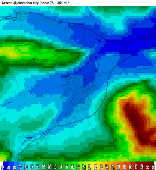
Below is the Elevation map of Aerzen, which displays elevation range with different colors. Scale of the first map is from 78 to 351 m (256 to 1152 ft) with average elevation of 144.2 meters (=473 ft) [note 1]
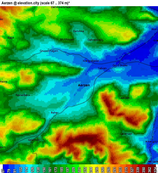
These maps also provides idea of topography and contour of this city, they are displayed at different zoom levels. More info about maps, scale and edge coordinates you can find below images.
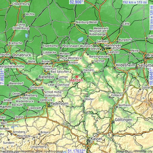
| \ | Map #1 | Map #2 | Topo.Map |
| Scale [m] | 78..351 m | 67..374 m | × |
| Scale [ft] | 256..1152 ft | 220..1227 ft | × |
| Average | 144.2 m = 473 ft | 181.3 m = 595 ft | × |
| Width | 6.01 km = 3.7 mi | 12.02 km = 7.5 mi | 192.3 km = 119.5 mi |
| Height | 6.01 km = 3.7 mi | 12.02 km = 7.5 mi | 192.3 km = 119.5 mi |
| ↑Max Latitude | 52.076547° | 52.103548° | 52.906° |
| Latitude at center | 52.04953° | 52.04953° | 52.04953° |
| ↓Min Latitude | 52.022496° | 51.995446° | 51.17632° |
| ← Min Longitude | 9.214615° | 9.170669° | 7.85231° |
| Longitude center | 9.25856° | 9.25856° | 9.25856° |
| →Max Longitude | 9.302505° | 9.346451° | 10.66481° |
Nearby cities:
Cities around Aerzen sort by population:
• Hameln elevation 74 m
9 km,  47°
47°
• Rinteln 60 m
19.5 km,  321°
321°
• Bad Pyrmont 113 m
7.1 km,  183°
183°
• Hessisch Oldendorf 68 m
13.7 km,  357°
357°
• Blomberg 184 m
16.5 km,  224°
224°
• Lügde 106 m
10.2 km, 184°
• Barntrup 196 m
11.7 km,  235°
235°
• Schieder-Schwalenberg 218 m
19.7 km,  192°
192°
• Dörentrup 156 m
17.5 km,  266°
266°
• Hehlen 73 m
16 km,  115°
115°
• Ottenstein 290 m
15.3 km,  138°
138°
• Polle 92 m
19.5 km,  149°
149°
Multilingual:
 En español:
Aerzen elevación 105 m.
 En France:
Aerzen élévation 105 m.


Sources and notes:
- [note 1] Map square and city borders are not equal. Map elevation data is calculated only from area inside that square.
- [src 1] Elevation data from geonames database provided with same terms of usage.
- [src 2] The elevation map of Aerzen is generated using elevation data from NASA's 3 arcsec (90m) resolution SRTM data.
- [src 3] Base (background) map © OpenStreetMap contributors tiles are generated by Geofabrik and OpenTopoMap.
Copyright & License:
This Aerzen Elevation Map is licensed under CC BY-SA. You may reuse any part from this page, if you give a proper credit by linking to this URL:
 More info on terms of use page.