Bad Brambach elevation
Bad Brambach (Saxony), Germany elevation is 579 meters and Bad Brambach elevation in feet is 1900 ft above sea level [src 1]. Bad Brambach is a seat of a fourth-order administrative division (feature code) with elevation that is 321 meters (1053 ft) bigger than average city elevation in Germany.
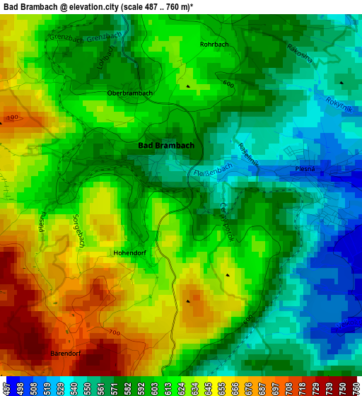
Below is the Elevation map of Bad Brambach, which displays elevation range with different colors. Scale of the first map is from 487 to 760 m (1598 to 2493 ft) with average elevation of 602.3 meters (=1976 ft) [note 1]
These maps also provides idea of topography and contour of this city, they are displayed at different zoom levels. More info about maps, scale and edge coordinates you can find below images.
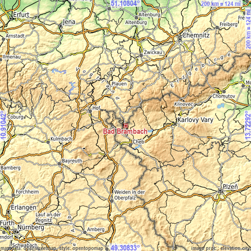
| \ | Map #1 | Topo.Map |
| Scale [m] | 487..760 m | × |
| Scale [ft] | 1598..2493 ft | × |
| Average | 602.3 m = 1976 ft | × |
| Width | 6.25 km = 3.9 mi | 200.1 km = 124.3 mi |
| Height | 6.25 km = 3.9 mi | 200.1 km = 124.3 mi |
| ↑Max Latitude | 50.244782° | 51.10804° |
| Latitude at center | 50.21667° | 50.21667° |
| ↓Min Latitude | 50.188542° | 49.30833° |
| ← Min Longitude | 12.272725° | 10.91042° |
| Longitude center | 12.31667° | 12.31667° |
| →Max Longitude | 12.360615° | 13.72292° |
Nearby cities:
Cities around Bad Brambach sort by population:
• Selb elevation 546 m
14.2 km,  248°
248°
• Klingenthal 604 m
19.1 km,  33°
33°
• Markneukirchen 500 m
10.6 km,  4°
4°
• Adorf 443 m
12.2 km,  340°
340°
• Bad Elster 507 m
9.3 km,  321°
321°
• Schönwald 643 m
16.6 km,  263°
263°
• Schöneck 701 m
19.3 km, 2°
• Erlbach 567 m
11.7 km,  17°
17°
• Hohenberg an der Eger 513 m
15.2 km,  206°
206°
• Zwota 596 m
16.7 km, 26°
• Schirnding 457 m
16.3 km,  203°
203°
• Eichigt 555 m
18.3 km, 324°
Multilingual:
 En español:
Bad Brambach elevación 579 m.
 En France:
Bad Brambach élévation 579 m.
 Auf Deutsch:
Bad Brambach höhe über dem Meeresspiegel ist 579 m.

Sources and notes:
- [note 1] Map square and city borders are not equal. Map elevation data is calculated only from area inside that square.
- [src 1] Elevation data from geonames database provided with same terms of usage.
- [src 2] The elevation map of Bad Brambach is generated using elevation data from NASA's 3 arcsec (90m) resolution SRTM data.
- [src 3] Base (background) map © OpenStreetMap contributors tiles are generated by Geofabrik and OpenTopoMap.
Copyright & License:
This Bad Brambach Elevation Map is licensed under CC BY-SA. You may reuse any part from this page, if you give a proper credit by linking to this URL:
 More info on terms of use page.