Schöneck elevation
Schöneck (Saxony), Germany elevation is 701 meters and Schöneck elevation in feet is 2300 ft above sea level [src 1]. Schöneck is a populated place (feature code) with elevation that is 443 meters (1453 ft) bigger than average city elevation in Germany.
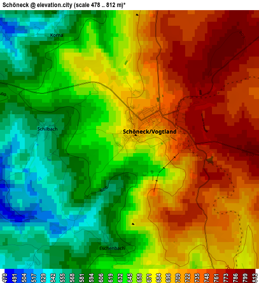
Below is the Elevation map of Schöneck, which displays elevation range with different colors. Scale of the first map is from 478 to 812 m (1568 to 2664 ft) with average elevation of 663.1 meters (=2176 ft) [note 1]
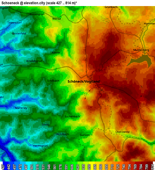
These maps also provides idea of topography and contour of this city, they are displayed at different zoom levels. More info about maps, scale and edge coordinates you can find below images.
| \ | Map #1 | Map #2 | Topo.Map |
| Scale [m] | 478..812 m | 427..814 m | × |
| Scale [ft] | 1568..2664 ft | 1401..2671 ft | × |
| Average | 663.1 m = 2176 ft | 638.6 m = 2095 ft | × |
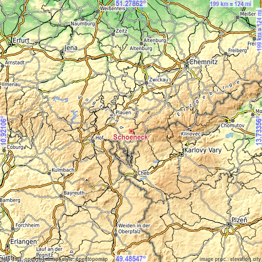
| Width | 6.23 km = 3.9 mi | 12.46 km = 7.7 mi | 199.4 km = 123.9 mi |
| Height | 6.23 km = 3.9 mi | 12.46 km = 7.7 mi | 199.4 km = 123.9 mi |
| ↑Max Latitude | 50.418529° | 50.446522° | 51.27862° |
| Latitude at center | 50.39052° | 50.39052° | 50.39052° |
| ↓Min Latitude | 50.362494° | 50.334452° | 49.48547° |
| ← Min Longitude | 12.283365° | 12.239419° | 10.92106° |
| Longitude center | 12.32731° | 12.32731° | 12.32731° |
| →Max Longitude | 12.371255° | 12.415201° | 13.73356° |
Nearby cities:
Cities around Schöneck sort by population:
• Falkenstein elevation 567 m
10.2 km,  17°
17°
• Markneukirchen 500 m
8.8 km,  178°
178°
• Adorf 443 m
9.2 km,  211°
211°
• Pöhl 721 m
0.3 km, 23°
• Grünbach 697 m
7 km, 20°
• Erlbach 567 m
8.7 km,  161°
161°
• Werda 619 m
5.5 km,  343°
343°
• Tirpersdorf 480 m
7.3 km,  310°
310°
• Zwota 596 m
8 km,  123°
123°
• Hammerbrücke 675 m
7.9 km,  51°
51°
• Neustadt Vogtland 606 m
7.8 km,  2°
2°
• Bergen 464 m
9.7 km, 337°
Multilingual:
 En español:
Schöneck elevación 701 m.
 En France:
Schöneck élévation 701 m.
 Auf Deutsch:
Schöneck höhe über dem Meeresspiegel ist 701 m.

Sources and notes:
- [note 1] Map square and city borders are not equal. Map elevation data is calculated only from area inside that square.
- [src 1] Elevation data from geonames database provided with same terms of usage.
- [src 2] The elevation map of Schöneck is generated using elevation data from NASA's 3 arcsec (90m) resolution SRTM data.
- [src 3] Base (background) map © OpenStreetMap contributors tiles are generated by Geofabrik and OpenTopoMap.
Copyright & License:
This Schöneck Elevation Map is licensed under CC BY-SA. You may reuse any part from this page, if you give a proper credit by linking to this URL:
 More info on terms of use page.