Bruchköbel elevation
Bruchköbel (Hesse, Regierungsbezirk Darmstadt), Germany elevation is 116 meters and Bruchköbel elevation in feet is 381 ft above sea level [src 1]. Bruchköbel is a populated place (feature code) with elevation that is 142 meters (466 ft) smaller than average city elevation in Germany.
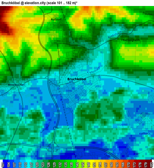
Below is the Elevation map of Bruchköbel, which displays elevation range with different colors. Scale of the first map is from 101 to 182 m (331 to 597 ft) with average elevation of 124.5 meters (=408 ft) [note 1]
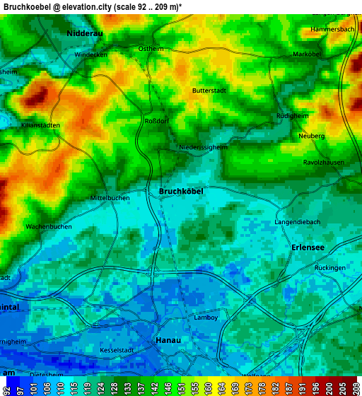
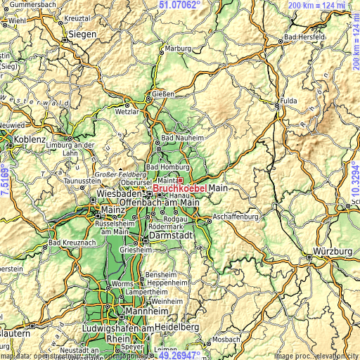
These maps also provides idea of topography and contour of this city, they are displayed at different zoom levels. More info about maps, scale and edge coordinates you can find below images.
| \ | Map #1 | Map #2 | Topo.Map |
| Scale [m] | 101..182 m | 92..209 m | × |
| Scale [ft] | 331..597 ft | 302..686 ft | × |
| Average | 124.5 m = 408 ft | 130.2 m = 427 ft | × |
| Width | 6.26 km = 3.9 mi | 12.52 km = 7.8 mi | 200.3 km = 124.5 mi |
| Height | 6.26 km = 3.9 mi | 12.52 km = 7.8 mi | 200.3 km = 124.5 mi |
| ↑Max Latitude | 50.206664° | 50.234782° | 51.07062° |
| Latitude at center | 50.17853° | 50.17853° | 50.17853° |
| ↓Min Latitude | 50.150379° | 50.122212° | 49.26947° |
| ← Min Longitude | 8.879205° | 8.835259° | 7.5169° |
| Longitude center | 8.92315° | 8.92315° | 8.92315° |
| →Max Longitude | 8.967095° | 9.011041° | 10.3294° |
Nearby cities:
Cities around Bruchköbel sort by population:
• Hanau am Main elevation 107 m
5 km,  187°
187°
• Maintal 107 m
7.1 km,  243°
243°
• Mühlheim am Main 103 m
9.4 km,  222°
222°
• Karben 118 m
12.2 km,  298°
298°
• Nidderau 125 m
7.7 km,  328°
328°
• Erlensee 114 m
4.3 km,  113°
113°
• Langenselbold 124 m
8.3 km,  91°
91°
• Altenstadt 133 m
12.2 km,  6°
6°
• Rodenbach 127 m
8.5 km, 112°
• Großkrotzenburg 109 m
11.4 km,  157°
157°
• Hammersbach 135 m
6 km,  45°
45°
• Niederdorfelden 117 m
8.9 km,  281°
281°
Multilingual:
 En español:
Bruchköbel elevación 116 m.
 En France:
Bruchköbel élévation 116 m.
 Auf Deutsch:
Bruchköbel höhe über dem Meeresspiegel ist 116 m.

Sources and notes:
- [note 1] Map square and city borders are not equal. Map elevation data is calculated only from area inside that square.
- [src 1] Elevation data from geonames database provided with same terms of usage.
- [src 2] The elevation map of Bruchköbel is generated using elevation data from NASA's 3 arcsec (90m) resolution SRTM data.
- [src 3] Base (background) map © OpenStreetMap contributors tiles are generated by Geofabrik and OpenTopoMap.
Copyright & License:
This Bruchköbel Elevation Map is licensed under CC BY-SA. You may reuse any part from this page, if you give a proper credit by linking to this URL:
 More info on terms of use page.