Großkrotzenburg elevation
Großkrotzenburg (Hesse, Regierungsbezirk Darmstadt), Germany elevation is 109 meters and Großkrotzenburg elevation in feet is 358 ft above sea level [src 1]. Großkrotzenburg is a seat of a fourth-order administrative division (feature code) with elevation that is 149 meters (489 ft) smaller than average city elevation in Germany.
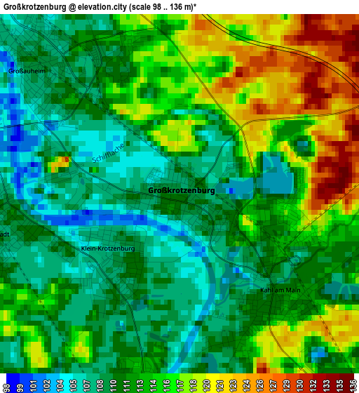
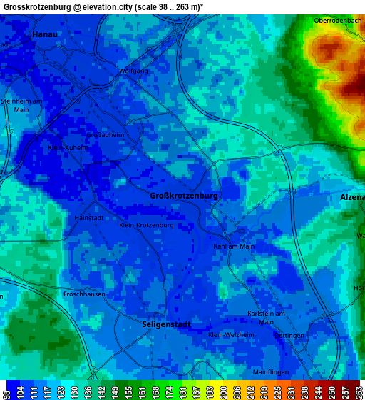
Below is the Elevation map of Großkrotzenburg, which displays elevation range with different colors. Scale of the first map is from 98 to 136 m (322 to 446 ft) with average elevation of 112.8 meters (=370 ft) [note 1]
These maps also provides idea of topography and contour of this city, they are displayed at different zoom levels. More info about maps, scale and edge coordinates you can find below images.
| \ | Map #1 | Map #2 | Topo.Map |
| Scale [m] | 98..136 m | 98..263 m | × |
| Scale [ft] | 322..446 ft | 322..863 ft | × |
| Average | 112.8 m = 370 ft | 122.7 m = 403 ft | × |
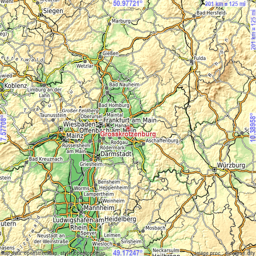
| Width | 6.27 km = 3.9 mi | 12.54 km = 7.8 mi | 200.7 km = 124.7 mi |
| Height | 6.27 km = 3.9 mi | 12.54 km = 7.8 mi | 200.7 km = 124.7 mi |
| ↑Max Latitude | 50.11152° | 50.139694° | 50.97721° |
| Latitude at center | 50.08333° | 50.08333° | 50.08333° |
| ↓Min Latitude | 50.055123° | 50.0269° | 49.17247° |
| ← Min Longitude | 8.939385° | 8.895439° | 7.57708° |
| Longitude center | 8.98333° | 8.98333° | 8.98333° |
| →Max Longitude | 9.027275° | 9.071221° | 10.38958° |
Nearby cities:
Cities around Großkrotzenburg sort by population:
• Hanau am Main elevation 107 m
7.5 km,  318°
318°
• Rodgau 129 m
9.4 km,  227°
227°
• Mühlheim am Main 103 m
11.3 km,  289°
289°
• Obertshausen 123 m
9.5 km,  261°
261°
• Bruchköbel 116 m
11.4 km,  337°
337°
• Seligenstadt 112 m
4.5 km,  188°
188°
• Alzenau in Unterfranken 132 m
5.8 km,  84°
84°
• Erlensee 114 m
8.9 km,  357°
357°
• Langenselbold 124 m
11.1 km,  21°
21°
• Rodenbach 127 m
8.2 km,  25°
25°
• Kleinostheim 113 m
11 km,  147°
147°
• Kahl am Main 109 m
2.2 km,  133°
133°
Multilingual:
 En español:
Großkrotzenburg elevación 109 m.
 En France:
Großkrotzenburg élévation 109 m.
 Auf Deutsch:
Großkrotzenburg höhe über dem Meeresspiegel ist 109 m.

Sources and notes:
- [note 1] Map square and city borders are not equal. Map elevation data is calculated only from area inside that square.
- [src 1] Elevation data from geonames database provided with same terms of usage.
- [src 2] The elevation map of Großkrotzenburg is generated using elevation data from NASA's 3 arcsec (90m) resolution SRTM data.
- [src 3] Base (background) map © OpenStreetMap contributors tiles are generated by Geofabrik and OpenTopoMap.
Copyright & License:
This Großkrotzenburg Elevation Map is licensed under CC BY-SA. You may reuse any part from this page, if you give a proper credit by linking to this URL:
 More info on terms of use page.