Rodgau elevation
Rodgau (Hesse, Regierungsbezirk Darmstadt), Germany elevation is 129 meters and Rodgau elevation in feet is 423 ft above sea level [src 1]. Rodgau is a seat of a fourth-order administrative division (feature code) with elevation that is 129 meters (423 ft) smaller than average city elevation in Germany.
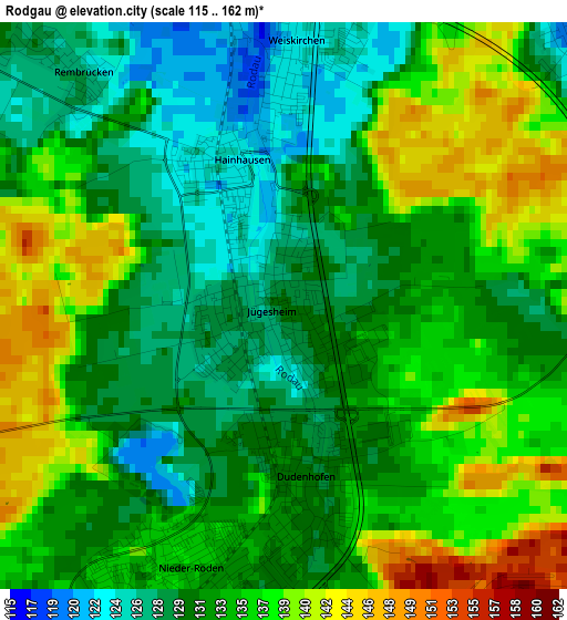
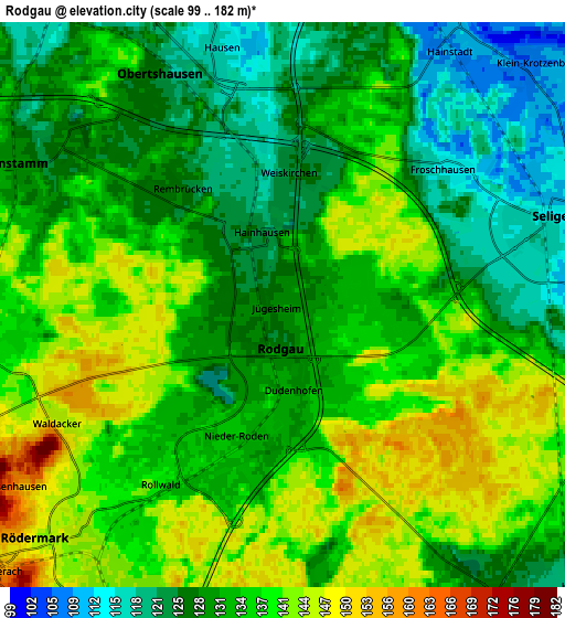
Below is the Elevation map of Rodgau, which displays elevation range with different colors. Scale of the first map is from 115 to 162 m (377 to 531 ft) with average elevation of 133.4 meters (=438 ft) [note 1]
These maps also provides idea of topography and contour of this city, they are displayed at different zoom levels. More info about maps, scale and edge coordinates you can find below images.
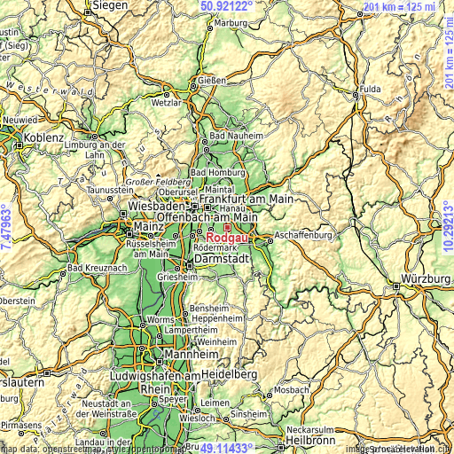
| \ | Map #1 | Map #2 | Topo.Map |
| Scale [m] | 115..162 m | 99..182 m | × |
| Scale [ft] | 377..531 ft | 325..597 ft | × |
| Average | 133.4 m = 438 ft | 133.6 m = 438 ft | × |
| Width | 6.28 km = 3.9 mi | 12.56 km = 7.8 mi | 200.9 km = 124.8 mi |
| Height | 6.28 km = 3.9 mi | 12.56 km = 7.8 mi | 200.9 km = 124.8 mi |
| ↑Max Latitude | 50.054494° | 50.082701° | 50.92122° |
| Latitude at center | 50.02627° | 50.02627° | 50.02627° |
| ↓Min Latitude | 49.99803° | 49.969773° | 49.11433° |
| ← Min Longitude | 8.841935° | 8.797989° | 7.47963° |
| Longitude center | 8.88588° | 8.88588° | 8.88588° |
| →Max Longitude | 8.929825° | 8.973771° | 10.29213° |
Nearby cities:
Cities around Rodgau sort by population:
• Offenbach elevation 113 m
11.9 km,  314°
314°
• Hanau am Main 107 m
12.2 km,  9°
9°
• Dietzenbach 152 m
7.9 km,  256°
256°
• Mühlheim am Main 103 m
10.7 km,  339°
339°
• Obertshausen 123 m
5.6 km,  333°
333°
• Seligenstadt 112 m
6.6 km,  73°
73°
• Heusenstamm 130 m
6.9 km,  298°
298°
• Babenhausen 127 m
8.2 km,  145°
145°
• Münster 139 m
11.6 km,  186°
186°
• Kahl am Main 109 m
9.8 km,  60°
60°
• Großkrotzenburg 109 m
9.4 km,  47°
47°
• Eppertshausen 138 m
8.7 km,  195°
195°
Multilingual:
 En español:
Rodgau elevación 129 m.
 En France:
Rodgau élévation 129 m.


Sources and notes:
- [note 1] Map square and city borders are not equal. Map elevation data is calculated only from area inside that square.
- [src 1] Elevation data from geonames database provided with same terms of usage.
- [src 2] The elevation map of Rodgau is generated using elevation data from NASA's 3 arcsec (90m) resolution SRTM data.
- [src 3] Base (background) map © OpenStreetMap contributors tiles are generated by Geofabrik and OpenTopoMap.
Copyright & License:
This Rodgau Elevation Map is licensed under CC BY-SA. You may reuse any part from this page, if you give a proper credit by linking to this URL:
 More info on terms of use page.