Bruckmühl elevation
Bruckmühl (Bavaria, Upper Bavaria), Germany elevation is 514 meters and Bruckmühl elevation in feet is 1686 ft above sea level [src 1]. Bruckmühl is a populated place (feature code) with elevation that is 256 meters (840 ft) bigger than average city elevation in Germany.
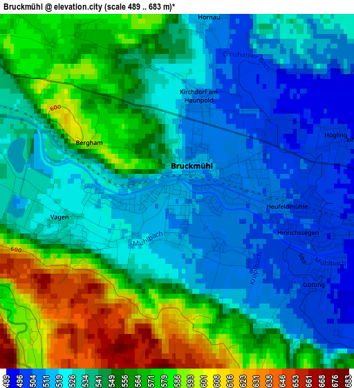
Below is the Elevation map of Bruckmühl, which displays elevation range with different colors. Scale of the first map is from 489 to 683 m (1604 to 2241 ft) with average elevation of 544.2 meters (=1785 ft) [note 1]
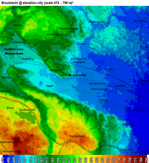
These maps also provides idea of topography and contour of this city, they are displayed at different zoom levels. More info about maps, scale and edge coordinates you can find below images.
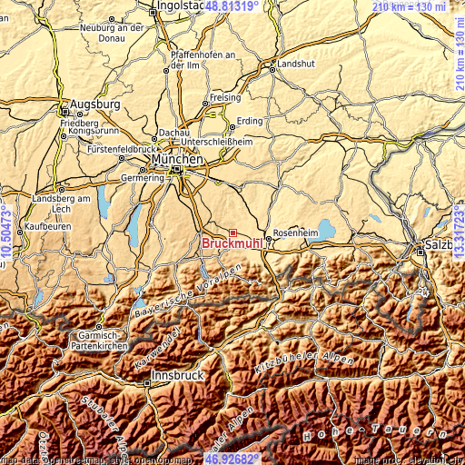
| \ | Map #1 | Map #2 | Topo.Map |
| Scale [m] | 489..683 m | 474..796 m | × |
| Scale [ft] | 1604..2241 ft | 1555..2612 ft | × |
| Average | 544.2 m = 1785 ft | 568.4 m = 1865 ft | × |
| Width | 6.55 km = 4.1 mi | 13.11 km = 8.1 mi | 209.7 km = 130.3 mi |
| Height | 6.55 km = 4.1 mi | 13.11 km = 8.1 mi | 209.7 km = 130.3 mi |
| ↑Max Latitude | 47.908056° | 47.937505° | 48.81319° |
| Latitude at center | 47.87859° | 47.87859° | 47.87859° |
| ↓Min Latitude | 47.849107° | 47.819608° | 46.92682° |
| ← Min Longitude | 11.867035° | 11.823089° | 10.50473° |
| Longitude center | 11.91098° | 11.91098° | 11.91098° |
| →Max Longitude | 11.954925° | 11.998871° | 13.31723° |
Nearby cities:
Cities around Bruckmühl sort by population:
• Kolbermoor elevation 461 m
12.1 km,  105°
105°
• Bad Aibling 482 m
7.6 km,  102°
102°
• Miesbach 700 m
11.5 km,  210°
210°
• Feldkirchen-Westerham 553 m
6 km,  302°
302°
• Bad Feilnbach 520 m
13.8 km,  147°
147°
• Großkarolinenfeld 468 m
12.8 km,  83°
83°
• Tuntenhausen 503 m
10 km,  51°
51°
• Glonn 535 m
12.5 km,  344°
344°
• Weyarn 673 m
8.6 km,  254°
254°
• Irschenberg 729 m
5.1 km,  175°
175°
• Valley 650 m
10 km,  279°
279°
• Vagen 527 m
2 km,  255°
255°
Multilingual:
 En español:
Bruckmühl elevación 514 m.
 En France:
Bruckmühl élévation 514 m.
 Auf Deutsch:
Bruckmühl höhe über dem Meeresspiegel ist 514 m.

Sources and notes:
- [note 1] Map square and city borders are not equal. Map elevation data is calculated only from area inside that square.
- [src 1] Elevation data from geonames database provided with same terms of usage.
- [src 2] The elevation map of Bruckmühl is generated using elevation data from NASA's 3 arcsec (90m) resolution SRTM data.
- [src 3] Base (background) map © OpenStreetMap contributors tiles are generated by Geofabrik and OpenTopoMap.
Copyright & License:
This Bruckmühl Elevation Map is licensed under CC BY-SA. You may reuse any part from this page, if you give a proper credit by linking to this URL:
 More info on terms of use page.