Tuntenhausen elevation
Tuntenhausen (Bavaria, Upper Bavaria), Germany elevation is 503 meters and Tuntenhausen elevation in feet is 1650 ft above sea level [src 1]. Tuntenhausen is a seat of a fourth-order administrative division (feature code) with elevation that is 245 meters (804 ft) bigger than average city elevation in Germany.
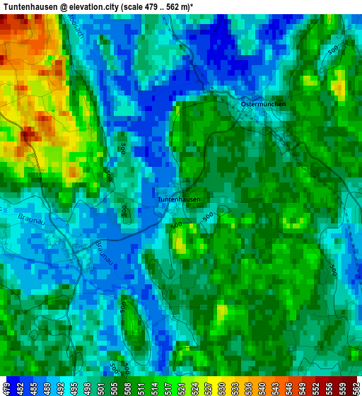
Below is the Elevation map of Tuntenhausen, which displays elevation range with different colors. Scale of the first map is from 479 to 562 m (1572 to 1844 ft) with average elevation of 502.7 meters (=1649 ft) [note 1]
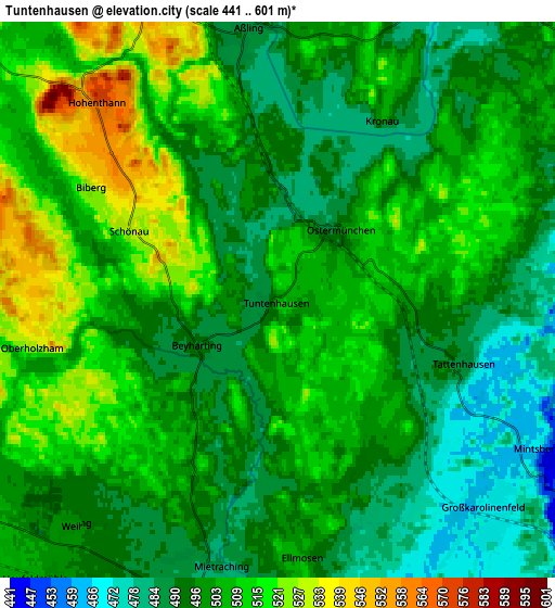
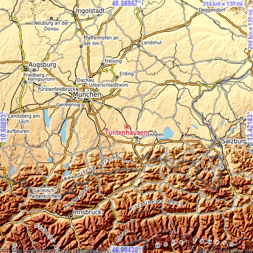
These maps also provides idea of topography and contour of this city, they are displayed at different zoom levels. More info about maps, scale and edge coordinates you can find below images.
| \ | Map #1 | Map #2 | Topo.Map |
| Scale [m] | 479..562 m | 441..601 m | × |
| Scale [ft] | 1572..1844 ft | 1447..1972 ft | × |
| Average | 502.7 m = 1649 ft | 501.4 m = 1645 ft | × |
| Width | 6.55 km = 4.1 mi | 13.09 km = 8.1 mi | 209.5 km = 130.2 mi |
| Height | 6.55 km = 4.1 mi | 13.09 km = 8.1 mi | 209.5 km = 130.2 mi |
| ↑Max Latitude | 47.964524° | 47.993941° | 48.86867° |
| Latitude at center | 47.93509° | 47.93509° | 47.93509° |
| ↓Min Latitude | 47.905639° | 47.876172° | 46.98435° |
| ← Min Longitude | 11.971235° | 11.927289° | 10.60893° |
| Longitude center | 12.01518° | 12.01518° | 12.01518° |
| →Max Longitude | 12.059125° | 12.103071° | 13.42143° |
Nearby cities:
Cities around Tuntenhausen sort by population:
• Rosenheim elevation 448 m
11.9 km,  137°
137°
• Kolbermoor 461 m
10.3 km,  157°
157°
• Bad Aibling 482 m
7.9 km,  182°
182°
• Bruckmühl 514 m
10 km,  231°
231°
• Großkarolinenfeld 468 m
6.9 km,  134°
134°
• Schechen 441 m
8.1 km,  94°
94°
• Aßling 488 m
6.5 km,  354°
354°
• Rott 465 m
5.7 km,  107°
107°
• Vagen 527 m
11.9 km,  235°
235°
• Eschenlohe 543 m
9.2 km,  6°
6°
• Emmering 484 m
7.6 km,  23°
23°
• Fraueneuharting 527 m
11.8 km, 11°
Multilingual:
 En español:
Tuntenhausen elevación 503 m.
 En France:
Tuntenhausen élévation 503 m.
 Auf Deutsch:
Tuntenhausen höhe über dem Meeresspiegel ist 503 m.

Sources and notes:
- [note 1] Map square and city borders are not equal. Map elevation data is calculated only from area inside that square.
- [src 1] Elevation data from geonames database provided with same terms of usage.
- [src 2] The elevation map of Tuntenhausen is generated using elevation data from NASA's 3 arcsec (90m) resolution SRTM data.
- [src 3] Base (background) map © OpenStreetMap contributors tiles are generated by Geofabrik and OpenTopoMap.
Copyright & License:
This Tuntenhausen Elevation Map is licensed under CC BY-SA. You may reuse any part from this page, if you give a proper credit by linking to this URL:
 More info on terms of use page.