Großkarolinenfeld elevation
Großkarolinenfeld (Bavaria, Upper Bavaria), Germany elevation is 468 meters and Großkarolinenfeld elevation in feet is 1535 ft above sea level [src 1]. Großkarolinenfeld is a seat of a fourth-order administrative division (feature code) with elevation that is 210 meters (689 ft) bigger than average city elevation in Germany.
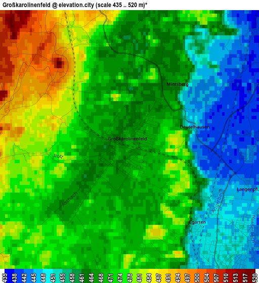
Below is the Elevation map of Großkarolinenfeld, which displays elevation range with different colors. Scale of the first map is from 435 to 520 m (1427 to 1706 ft) with average elevation of 468 meters (=1535 ft) [note 1]
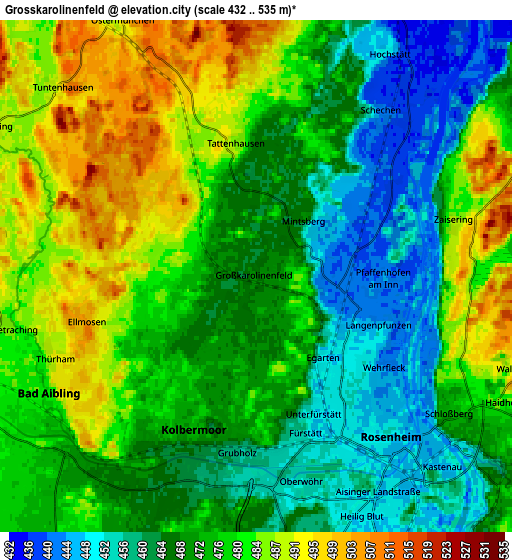
These maps also provides idea of topography and contour of this city, they are displayed at different zoom levels. More info about maps, scale and edge coordinates you can find below images.
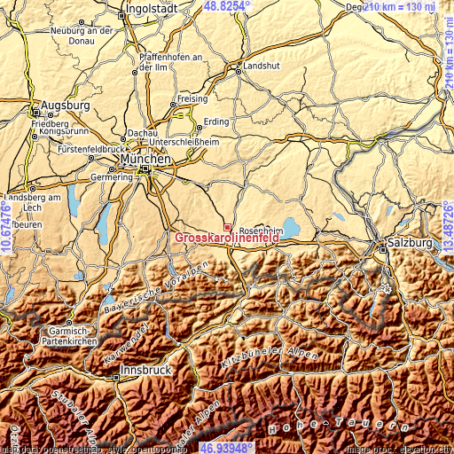
| \ | Map #1 | Map #2 | Topo.Map |
| Scale [m] | 435..520 m | 432..535 m | × |
| Scale [ft] | 1427..1706 ft | 1417..1755 ft | × |
| Average | 468 m = 1535 ft | 473.3 m = 1553 ft | × |
| Width | 6.55 km = 4.1 mi | 13.11 km = 8.1 mi | 209.7 km = 130.3 mi |
| Height | 6.55 km = 4.1 mi | 13.11 km = 8.1 mi | 209.7 km = 130.3 mi |
| ↑Max Latitude | 47.920479° | 47.949921° | 48.8254° |
| Latitude at center | 47.89102° | 47.89102° | 47.89102° |
| ↓Min Latitude | 47.861544° | 47.832052° | 46.93948° |
| ← Min Longitude | 12.037065° | 11.993119° | 10.67476° |
| Longitude center | 12.08101° | 12.08101° | 12.08101° |
| →Max Longitude | 12.124955° | 12.168901° | 13.48726° |
Nearby cities:
Cities around Großkarolinenfeld sort by population:
• Rosenheim elevation 448 m
4.9 km,  141°
141°
• Kolbermoor 461 m
4.7 km,  192°
192°
• Bad Aibling 482 m
6.1 km,  240°
240°
• Raubling 460 m
11.4 km,  168°
168°
• Stephanskirchen 483 m
8.8 km,  117°
117°
• Tuntenhausen 503 m
6.9 km,  314°
314°
• Riedering 489 m
11.1 km, 121°
• Schechen 441 m
5.3 km,  37°
37°
• Rott 465 m
3.3 km,  8°
8°
• Vogtareuth 485 m
9.7 km,  50°
50°
• Söchtenau 482 m
11.9 km,  68°
68°
• Prutting 492 m
9.1 km,  88°
88°
Multilingual:
 En español:
Großkarolinenfeld elevación 468 m.
 En France:
Großkarolinenfeld élévation 468 m.
 Auf Deutsch:
Großkarolinenfeld höhe über dem Meeresspiegel ist 468 m.
 На русском:
Гроскаролиненфельд высота над уровнем моря 468 м
Sources and notes:
- [note 1] Map square and city borders are not equal. Map elevation data is calculated only from area inside that square.
- [src 1] Elevation data from geonames database provided with same terms of usage.
- [src 2] The elevation map of Großkarolinenfeld is generated using elevation data from NASA's 3 arcsec (90m) resolution SRTM data.
- [src 3] Base (background) map © OpenStreetMap contributors tiles are generated by Geofabrik and OpenTopoMap.
Copyright & License:
This Großkarolinenfeld Elevation Map is licensed under CC BY-SA. You may reuse any part from this page, if you give a proper credit by linking to this URL:
 More info on terms of use page.