Bürgel elevation
Bürgel (Thuringia), Germany elevation is 255 meters and Bürgel elevation in feet is 837 ft above sea level [src 1]. Bürgel is a populated place (feature code) with elevation that is 3 meters (10 ft) smaller than average city elevation in Germany.
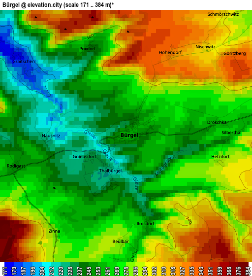
Below is the Elevation map of Bürgel, which displays elevation range with different colors. Scale of the first map is from 171 to 384 m (561 to 1260 ft) with average elevation of 274.9 meters (=902 ft) [note 1]
These maps also provides idea of topography and contour of this city, they are displayed at different zoom levels. More info about maps, scale and edge coordinates you can find below images.
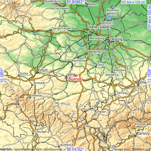
| \ | Map #1 | Topo.Map |
| Scale [m] | 171..384 m | × |
| Scale [ft] | 561..1260 ft | × |
| Average | 274.9 m = 902 ft | × |
| Width | 6.16 km = 3.8 mi | 197.1 km = 122.5 mi |
| Height | 6.16 km = 3.8 mi | 197 km = 122.4 mi |
| ↑Max Latitude | 50.969852° | 51.81983° |
| Latitude at center | 50.94217° | 50.94217° |
| ↓Min Latitude | 50.914472° | 50.04762° |
| ← Min Longitude | 11.712405° | 10.3501° |
| Longitude center | 11.75635° | 11.75635° |
| →Max Longitude | 11.800295° | 13.1626° |
Nearby cities:
Cities around Bürgel sort by population:
• Jena elevation 149 m
11.8 km,  262°
262°
• Eisenberg 289 m
10.6 km,  73°
73°
• Hermsdorf 331 m
8.6 km,  125°
125°
• Stadtroda 199 m
9.7 km,  192°
192°
• Bad Klosterlausnitz 322 m
8.2 km,  110°
110°
• Camburg 127 m
13 km,  345°
345°
• Schkölen 211 m
12 km,  22°
22°
• Lehesten 258 m
13 km,  290°
290°
• Sankt Gangloff 330 m
13.7 km, 134°
• Weißenborn 298 m
8.9 km,  103°
103°
• Tautenhain 346 m
11.6 km, 99°
• Frauenprießnitz 318 m
8.4 km, 348°
Multilingual:
 En español:
Bürgel elevación 255 m.
 En France:
Bürgel élévation 255 m.


Sources and notes:
- [note 1] Map square and city borders are not equal. Map elevation data is calculated only from area inside that square.
- [src 1] Elevation data from geonames database provided with same terms of usage.
- [src 2] The elevation map of Bürgel is generated using elevation data from NASA's 3 arcsec (90m) resolution SRTM data.
- [src 3] Base (background) map © OpenStreetMap contributors tiles are generated by Geofabrik and OpenTopoMap.
Copyright & License:
This Bürgel Elevation Map is licensed under CC BY-SA. You may reuse any part from this page, if you give a proper credit by linking to this URL:
 More info on terms of use page.