Hermsdorf elevation
Hermsdorf (Thuringia), Germany elevation is 331 meters and Hermsdorf elevation in feet is 1086 ft above sea level [src 1]. Hermsdorf is a seat of a fourth-order administrative division (feature code) with elevation that is 73 meters (240 ft) bigger than average city elevation in Germany.
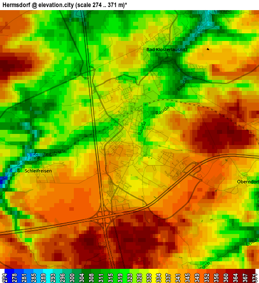
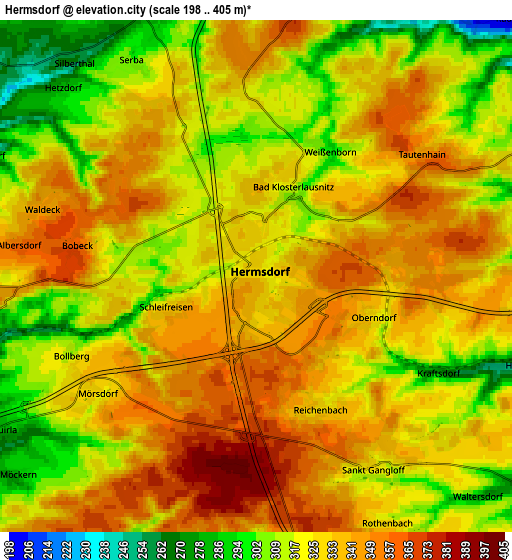
Below is the Elevation map of Hermsdorf, which displays elevation range with different colors. Scale of the first map is from 274 to 371 m (899 to 1217 ft) with average elevation of 335.2 meters (=1100 ft) [note 1]
These maps also provides idea of topography and contour of this city, they are displayed at different zoom levels. More info about maps, scale and edge coordinates you can find below images.
| \ | Map #1 | Map #2 | Topo.Map |
| Scale [m] | 274..371 m | 198..405 m | × |
| Scale [ft] | 899..1217 ft | 650..1329 ft | × |
| Average | 335.2 m = 1100 ft | 328.8 m = 1079 ft | × |
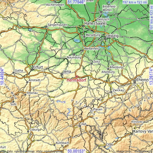
| Width | 6.16 km = 3.8 mi | 12.33 km = 7.7 mi | 197.2 km = 122.5 mi |
| Height | 6.16 km = 3.8 mi | 12.33 km = 7.7 mi | 197.2 km = 122.5 mi |
| ↑Max Latitude | 50.924649° | 50.952341° | 51.77546° |
| Latitude at center | 50.89694° | 50.89694° | 50.89694° |
| ↓Min Latitude | 50.869215° | 50.841473° | 50.00153° |
| ← Min Longitude | 11.811545° | 11.767599° | 10.44924° |
| Longitude center | 11.85549° | 11.85549° | 11.85549° |
| →Max Longitude | 11.899435° | 11.943381° | 13.26174° |
Nearby cities:
Cities around Hermsdorf sort by population:
• Gera elevation 203 m
16 km,  96°
96°
• Eisenberg 289 m
8.6 km,  22°
22°
• Stadtroda 199 m
10.1 km,  243°
243°
• Kraftsdorf 257 m
5.7 km,  114°
114°
• Bad Köstritz 186 m
11.5 km,  71°
71°
• Bad Klosterlausnitz 322 m
2.3 km, 19°
• Münchenbernsdorf 330 m
10 km,  147°
147°
• Bürgel 255 m
8.6 km,  305°
305°
• Sankt Gangloff 330 m
5.4 km, 149°
• Weißenborn 298 m
3.4 km,  29°
29°
• Tautenhain 346 m
5.4 km,  55°
55°
• Frauenprießnitz 318 m
15.8 km,  327°
327°
Multilingual:
 En español:
Hermsdorf elevación 331 m.
 En France:
Hermsdorf élévation 331 m.
 Auf Deutsch:
Hermsdorf höhe über dem Meeresspiegel ist 331 m.

Sources and notes:
- [note 1] Map square and city borders are not equal. Map elevation data is calculated only from area inside that square.
- [src 1] Elevation data from geonames database provided with same terms of usage.
- [src 2] The elevation map of Hermsdorf is generated using elevation data from NASA's 3 arcsec (90m) resolution SRTM data.
- [src 3] Base (background) map © OpenStreetMap contributors tiles are generated by Geofabrik and OpenTopoMap.
Copyright & License:
This Hermsdorf Elevation Map is licensed under CC BY-SA. You may reuse any part from this page, if you give a proper credit by linking to this URL:
 More info on terms of use page.