Gera elevation
Gera (Thuringia), Germany elevation is 203 meters and Gera elevation in feet is 666 ft above sea level [src 1]. Gera is a seat of a third-order administrative division (feature code) with elevation that is 55 meters (180 ft) smaller than average city elevation in Germany.
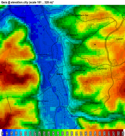
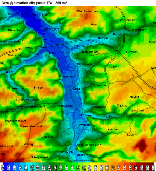
Below is the Elevation map of Gera, which displays elevation range with different colors. Scale of the first map is from 181 to 328 m (594 to 1076 ft) with average elevation of 243.2 meters (=798 ft) [note 1]
These maps also provides idea of topography and contour of this city, they are displayed at different zoom levels. More info about maps, scale and edge coordinates you can find below images.
| \ | Map #1 | Map #2 | Topo.Map |
| Scale [m] | 181..328 m | 174..369 m | × |
| Scale [ft] | 594..1076 ft | 571..1211 ft | × |
| Average | 243.2 m = 798 ft | 261.1 m = 857 ft | × |
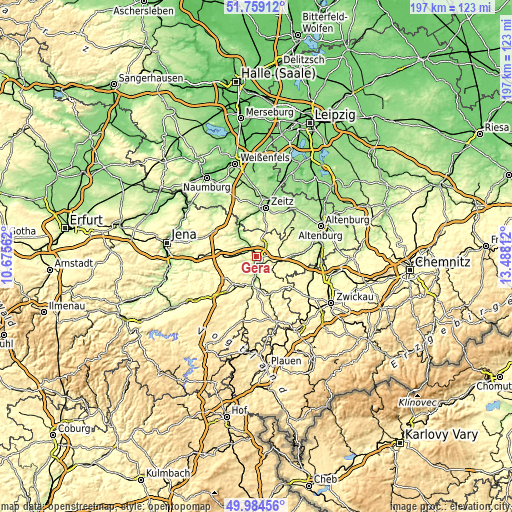
| Width | 6.17 km = 3.8 mi | 12.33 km = 7.7 mi | 197.3 km = 122.6 mi |
| Height | 6.17 km = 3.8 mi | 12.33 km = 7.7 mi | 197.3 km = 122.6 mi |
| ↑Max Latitude | 50.908009° | 50.935711° | 51.75912° |
| Latitude at center | 50.88029° | 50.88029° | 50.88029° |
| ↓Min Latitude | 50.852555° | 50.824803° | 49.98456° |
| ← Min Longitude | 12.037925° | 11.993979° | 10.67562° |
| Longitude center | 12.08187° | 12.08187° | 12.08187° |
| →Max Longitude | 12.125815° | 12.169761° | 13.48812° |
Nearby cities:
Cities around Gera sort by population:
• Weida elevation 239 m
11.9 km,  187°
187°
• Ronneburg 284 m
7.6 km,  104°
104°
• Kraftsdorf 257 m
10.7 km,  267°
267°
• Bad Köstritz 186 m
7.5 km,  317°
317°
• Münchenbernsdorf 330 m
12.4 km,  237°
237°
• Wünschendorf 214 m
9.4 km,  172°
172°
• Großenstein 273 m
8.6 km,  75°
75°
• Pölzig 285 m
11.3 km,  46°
46°
• Sankt Gangloff 330 m
13.4 km,  258°
258°
• Tautenhain 346 m
12.4 km,  293°
293°
• Löbichau 237 m
12.8 km, 83°
• Brahmenau 250 m
7.2 km, 48°
Multilingual:
 En español:
Gera elevación 203 m.
 En France:
Gera élévation 203 m.


Sources and notes:
- [note 1] Map square and city borders are not equal. Map elevation data is calculated only from area inside that square.
- [src 1] Elevation data from geonames database provided with same terms of usage.
- [src 2] The elevation map of Gera is generated using elevation data from NASA's 3 arcsec (90m) resolution SRTM data.
- [src 3] Base (background) map © OpenStreetMap contributors tiles are generated by Geofabrik and OpenTopoMap.
Copyright & License:
This Gera Elevation Map is licensed under CC BY-SA. You may reuse any part from this page, if you give a proper credit by linking to this URL:
 More info on terms of use page.