Ronneburg elevation
Ronneburg (Thuringia), Germany elevation is 284 meters and Ronneburg elevation in feet is 932 ft above sea level [src 1]. Ronneburg is a populated place (feature code) with elevation that is 26 meters (85 ft) bigger than average city elevation in Germany.
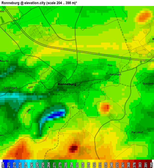
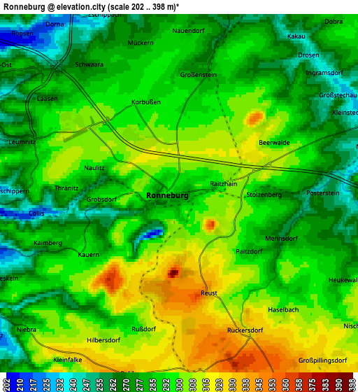
Below is the Elevation map of Ronneburg, which displays elevation range with different colors. Scale of the first map is from 204 to 398 m (669 to 1306 ft) with average elevation of 301.9 meters (=990 ft) [note 1]
These maps also provides idea of topography and contour of this city, they are displayed at different zoom levels. More info about maps, scale and edge coordinates you can find below images.
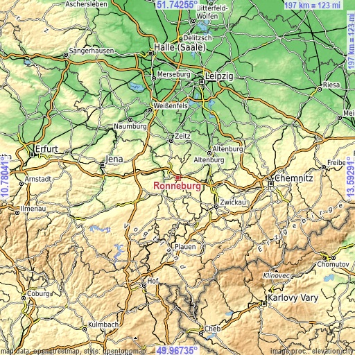
| \ | Map #1 | Map #2 | Topo.Map |
| Scale [m] | 204..398 m | 202..398 m | × |
| Scale [ft] | 669..1306 ft | 663..1306 ft | × |
| Average | 301.9 m = 990 ft | 290.1 m = 952 ft | × |
| Width | 6.17 km = 3.8 mi | 12.34 km = 7.7 mi | 197.4 km = 122.7 mi |
| Height | 6.17 km = 3.8 mi | 12.34 km = 7.7 mi | 197.4 km = 122.7 mi |
| ↑Max Latitude | 50.891129° | 50.918841° | 51.74255° |
| Latitude at center | 50.8634° | 50.8634° | 50.8634° |
| ↓Min Latitude | 50.835655° | 50.807893° | 49.96735° |
| ← Min Longitude | 12.142715° | 12.098769° | 10.78041° |
| Longitude center | 12.18666° | 12.18666° | 12.18666° |
| →Max Longitude | 12.230605° | 12.274551° | 13.59291° |
Nearby cities:
Cities around Ronneburg sort by population:
• Gera elevation 203 m
7.6 km,  284°
284°
• Schmölln 211 m
12.3 km,  72°
72°
• Weida 239 m
13.3 km,  221°
221°
• Berga 240 m
12.5 km,  187°
187°
• Wünschendorf 214 m
9.7 km, 219°
• Seelingstädt 303 m
10.9 km,  158°
158°
• Großenstein 273 m
4.2 km,  12°
12°
• Pölzig 285 m
9.7 km, 5°
• Löbichau 237 m
6.4 km,  57°
57°
• Altkirchen 224 m
13.8 km, 55°
• Brahmenau 250 m
7 km,  343°
343°
• Nöbdenitz 275 m
6.8 km,  86°
86°
Multilingual:
 En español:
Ronneburg elevación 284 m.
 En France:
Ronneburg élévation 284 m.
 Auf Deutsch:
Ronneburg höhe über dem Meeresspiegel ist 284 m.

Sources and notes:
- [note 1] Map square and city borders are not equal. Map elevation data is calculated only from area inside that square.
- [src 1] Elevation data from geonames database provided with same terms of usage.
- [src 2] The elevation map of Ronneburg is generated using elevation data from NASA's 3 arcsec (90m) resolution SRTM data.
- [src 3] Base (background) map © OpenStreetMap contributors tiles are generated by Geofabrik and OpenTopoMap.
Copyright & License:
This Ronneburg Elevation Map is licensed under CC BY-SA. You may reuse any part from this page, if you give a proper credit by linking to this URL:
 More info on terms of use page.