Burgsinn elevation
Burgsinn (Bavaria, Regierungsbezirk Unterfranken), Germany elevation is 194 meters and Burgsinn elevation in feet is 636 ft above sea level [src 1]. Burgsinn is a populated place (feature code) with elevation that is 64 meters (210 ft) smaller than average city elevation in Germany.
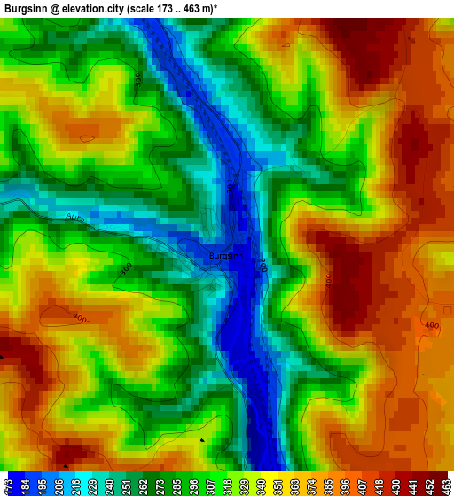
Below is the Elevation map of Burgsinn, which displays elevation range with different colors. Scale of the first map is from 173 to 463 m (568 to 1519 ft) with average elevation of 322.4 meters (=1058 ft) [note 1]
These maps also provides idea of topography and contour of this city, they are displayed at different zoom levels. More info about maps, scale and edge coordinates you can find below images.
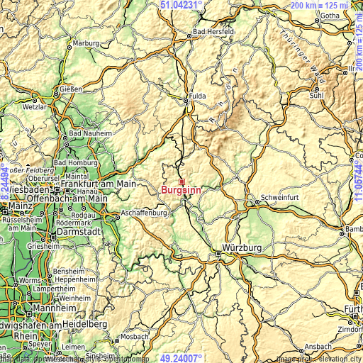
| \ | Map #1 | Topo.Map |
| Scale [m] | 173..463 m | × |
| Scale [ft] | 568..1519 ft | × |
| Average | 322.4 m = 1058 ft | × |
| Width | 6.26 km = 3.9 mi | 200.4 km = 124.5 mi |
| Height | 6.26 km = 3.9 mi | 200.4 km = 124.5 mi |
| ↑Max Latitude | 50.177831° | 51.04231° |
| Latitude at center | 50.14968° | 50.14968° |
| ↓Min Latitude | 50.121512° | 49.24007° |
| ← Min Longitude | 9.607245° | 8.24494° |
| Longitude center | 9.65119° | 9.65119° |
| →Max Longitude | 9.695135° | 11.05744° |
Nearby cities:
Cities around Burgsinn sort by population:
• Hammelburg elevation 193 m
17.5 km,  102°
102°
• Gemünden am Main 179 m
11.8 km,  160°
160°
• Frammersbach 228 m
16.1 km,  233°
233°
• Partenstein 202 m
15.2 km,  217°
217°
• Wartmannsroth 331 m
9.6 km,  78°
78°
• Zeitlofs 248 m
12.6 km,  6°
6°
• Rieneck 188 m
6.3 km,  182°
182°
• Karsbach 215 m
15.4 km,  141°
141°
• Gräfendorf 165 m
7 km,  115°
115°
• Schönau 168 m
9.6 km,  148°
148°
• Aura im Sinngrund 283 m
6.3 km,  300°
300°
• Obersinn 208 m
7 km,  338°
338°
Multilingual:
 En español:
Burgsinn elevación 194 m.
 En France:
Burgsinn élévation 194 m.
 Auf Deutsch:
Burgsinn höhe über dem Meeresspiegel ist 194 m.

Sources and notes:
- [note 1] Map square and city borders are not equal. Map elevation data is calculated only from area inside that square.
- [src 1] Elevation data from geonames database provided with same terms of usage.
- [src 2] The elevation map of Burgsinn is generated using elevation data from NASA's 3 arcsec (90m) resolution SRTM data.
- [src 3] Base (background) map © OpenStreetMap contributors tiles are generated by Geofabrik and OpenTopoMap.
Copyright & License:
This Burgsinn Elevation Map is licensed under CC BY-SA. You may reuse any part from this page, if you give a proper credit by linking to this URL:
 More info on terms of use page.