Karsbach elevation
Karsbach (Bavaria, Regierungsbezirk Unterfranken), Germany elevation is 215 meters and Karsbach elevation in feet is 705 ft above sea level [src 1]. Karsbach is a seat of a fourth-order administrative division (feature code) with elevation that is 43 meters (141 ft) smaller than average city elevation in Germany.
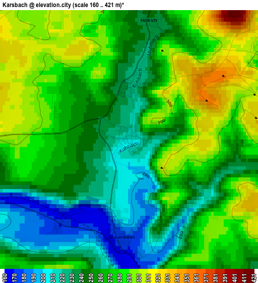
Below is the Elevation map of Karsbach, which displays elevation range with different colors. Scale of the first map is from 160 to 421 m (525 to 1381 ft) with average elevation of 263 meters (=863 ft) [note 1]
These maps also provides idea of topography and contour of this city, they are displayed at different zoom levels. More info about maps, scale and edge coordinates you can find below images.
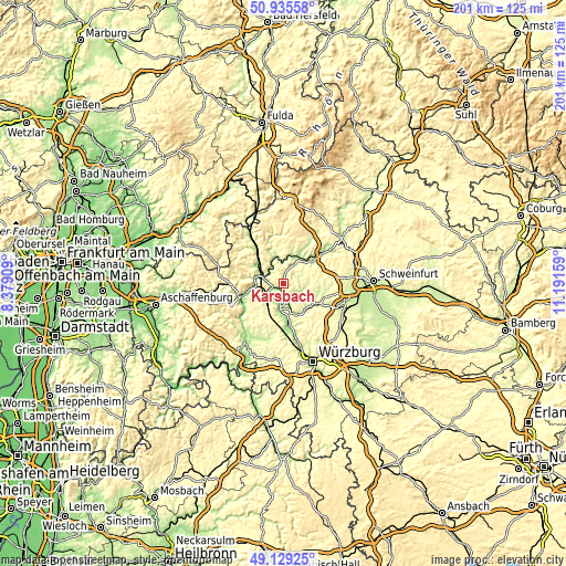
| \ | Map #1 | Topo.Map |
| Scale [m] | 160..421 m | × |
| Scale [ft] | 525..1381 ft | × |
| Average | 263 m = 863 ft | × |
| Width | 6.28 km = 3.9 mi | 200.8 km = 124.8 mi |
| Height | 6.28 km = 3.9 mi | 200.8 km = 124.8 mi |
| ↑Max Latitude | 50.069125° | 50.93558° |
| Latitude at center | 50.04091° | 50.04091° |
| ↓Min Latitude | 50.012678° | 49.12925° |
| ← Min Longitude | 9.741395° | 8.37909° |
| Longitude center | 9.78534° | 9.78534° |
| →Max Longitude | 9.829285° | 11.19159° |
Nearby cities:
Cities around Karsbach sort by population:
• Karlstadt elevation 172 m
9 km,  185°
185°
• Hammelburg 193 m
11.3 km,  42°
42°
• Gemünden am Main 179 m
5.7 km,  279°
279°
• Eußenheim 183 m
6.3 km,  164°
164°
• Erlenbach 283 m
12.2 km,  235°
235°
• Steinfeld 279 m
12.8 km,  220°
220°
• Rieneck 188 m
11.4 km,  300°
300°
• Fuchsstadt 209 m
13 km,  54°
54°
• Gräfendorf 165 m
9.6 km,  340°
340°
• Thüngen 212 m
12.2 km,  154°
154°
• Schönau 168 m
6 km,  310°
310°
• Gössenheim 172 m
2.7 km,  183°
183°
Multilingual:
 En español:
Karsbach elevación 215 m.
 En France:
Karsbach élévation 215 m.
 Auf Deutsch:
Karsbach höhe über dem Meeresspiegel ist 215 m.

Sources and notes:
- [note 1] Map square and city borders are not equal. Map elevation data is calculated only from area inside that square.
- [src 1] Elevation data from geonames database provided with same terms of usage.
- [src 2] The elevation map of Karsbach is generated using elevation data from NASA's 3 arcsec (90m) resolution SRTM data.
- [src 3] Base (background) map © OpenStreetMap contributors tiles are generated by Geofabrik and OpenTopoMap.
Copyright & License:
This Karsbach Elevation Map is licensed under CC BY-SA. You may reuse any part from this page, if you give a proper credit by linking to this URL:
 More info on terms of use page.