Dornhan elevation
Dornhan (Baden-Württemberg, Freiburg Region), Germany elevation is 642 meters and Dornhan elevation in feet is 2106 ft above sea level [src 1]. Dornhan is a populated place (feature code) with elevation that is 384 meters (1260 ft) bigger than average city elevation in Germany.
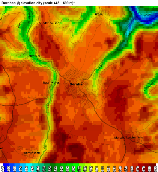
Below is the Elevation map of Dornhan, which displays elevation range with different colors. Scale of the first map is from 445 to 699 m (1460 to 2293 ft) with average elevation of 635 meters (=2083 ft) [note 1]
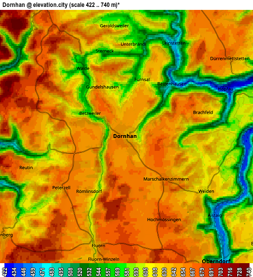
These maps also provides idea of topography and contour of this city, they are displayed at different zoom levels. More info about maps, scale and edge coordinates you can find below images.
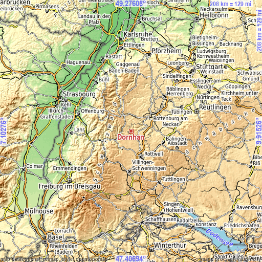
| \ | Map #1 | Map #2 | Topo.Map |
| Scale [m] | 445..699 m | 422..740 m | × |
| Scale [ft] | 1460..2293 ft | 1385..2428 ft | × |
| Average | 635 m = 2083 ft | 627.2 m = 2058 ft | × |
| Width | 6.49 km = 4 mi | 12.99 km = 8.1 mi | 207.8 km = 129.1 mi |
| Height | 6.49 km = 4 mi | 12.99 km = 8.1 mi | 207.8 km = 129.1 mi |
| ↑Max Latitude | 48.379277° | 48.408457° | 49.27608° |
| Latitude at center | 48.35008° | 48.35008° | 48.35008° |
| ↓Min Latitude | 48.320867° | 48.291636° | 47.40694° |
| ← Min Longitude | 8.465065° | 8.421119° | 7.10276° |
| Longitude center | 8.50901° | 8.50901° | 8.50901° |
| →Max Longitude | 8.552955° | 8.596901° | 9.91526° |
Nearby cities:
Cities around Dornhan sort by population:
• Oberndorf elevation 510 m
8.1 km,  144°
144°
• Sulz am Neckar 431 m
9.3 km,  81°
81°
• Alpirsbach 434 m
7.9 km,  265°
265°
• Loßburg 655 m
7.1 km,  321°
321°
• Aichhalden 705 m
12.1 km,  220°
220°
• Vöhringen 507 m
11.6 km,  98°
98°
• Epfendorf 482 m
13 km,  148°
148°
• Bösingen 658 m
13.3 km,  166°
166°
• Schopfloch 666 m
12.1 km,  15°
15°
• Glatten 560 m
10.3 km,  0°
0°
• Seedorf 661 m
11.3 km,  187°
187°
• Schenkenzell 361 m
11 km,  247°
247°
Multilingual:
 En español:
Dornhan elevación 642 m.
 En France:
Dornhan élévation 642 m.


Sources and notes:
- [note 1] Map square and city borders are not equal. Map elevation data is calculated only from area inside that square.
- [src 1] Elevation data from geonames database provided with same terms of usage.
- [src 2] The elevation map of Dornhan is generated using elevation data from NASA's 3 arcsec (90m) resolution SRTM data.
- [src 3] Base (background) map © OpenStreetMap contributors tiles are generated by Geofabrik and OpenTopoMap.
Copyright & License:
This Dornhan Elevation Map is licensed under CC BY-SA. You may reuse any part from this page, if you give a proper credit by linking to this URL:
 More info on terms of use page.