Glatten elevation
Glatten (Baden-Württemberg, Karlsruhe Region), Germany elevation is 560 meters and Glatten elevation in feet is 1837 ft above sea level [src 1]. Glatten is a seat of a fourth-order administrative division (feature code) with elevation that is 302 meters (991 ft) bigger than average city elevation in Germany.
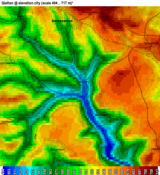
Below is the Elevation map of Glatten, which displays elevation range with different colors. Scale of the first map is from 494 to 717 m (1621 to 2352 ft) with average elevation of 617.9 meters (=2027 ft) [note 1]
These maps also provides idea of topography and contour of this city, they are displayed at different zoom levels. More info about maps, scale and edge coordinates you can find below images.
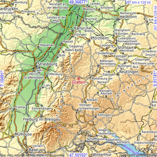
| \ | Map #1 | Topo.Map |
| Scale [m] | 494..717 m | × |
| Scale [ft] | 1621..2352 ft | × |
| Average | 617.9 m = 2027 ft | × |
| Width | 6.48 km = 4 mi | 207.5 km = 128.9 mi |
| Height | 6.48 km = 4 mi | 207.4 km = 128.9 mi |
| ↑Max Latitude | 48.471604° | 49.36677° |
| Latitude at center | 48.44246° | 48.44246° |
| ↓Min Latitude | 48.4133° | 47.50102° |
| ← Min Longitude | 8.467215° | 7.10491° |
| Longitude center | 8.51116° | 8.51116° |
| →Max Longitude | 8.555105° | 9.91741° |
Nearby cities:
Cities around Glatten sort by population:
• Horb am Neckar elevation 394 m
13.3 km,  89°
89°
• Freudenstadt 736 m
7.7 km,  290°
290°
• Baiersbronn 598 m
12 km,  304°
304°
• Sulz am Neckar 431 m
12.7 km,  134°
134°
• Dornstetten 641 m
3.4 km,  343°
343°
• Pfalzgrafenweiler 634 m
10.2 km,  23°
23°
• Alpirsbach 434 m
13.5 km,  216°
216°
• Loßburg 655 m
6.5 km, 223°
• Dornhan 642 m
10.3 km,  180°
180°
• Haiterbach 562 m
13.1 km,  48°
48°
• Schopfloch 666 m
3.3 km,  65°
65°
• Bad Rippoldsau-Schapbach 549 m
13.8 km,  263°
263°
Multilingual:
 En español:
Glatten elevación 560 m.
 En France:
Glatten élévation 560 m.


Sources and notes:
- [note 1] Map square and city borders are not equal. Map elevation data is calculated only from area inside that square.
- [src 1] Elevation data from geonames database provided with same terms of usage.
- [src 2] The elevation map of Glatten is generated using elevation data from NASA's 3 arcsec (90m) resolution SRTM data.
- [src 3] Base (background) map © OpenStreetMap contributors tiles are generated by Geofabrik and OpenTopoMap.
Copyright & License:
This Glatten Elevation Map is licensed under CC BY-SA. You may reuse any part from this page, if you give a proper credit by linking to this URL:
 More info on terms of use page.