Baiersbronn elevation
Baiersbronn (Baden-Württemberg, Karlsruhe Region), Germany elevation is 598 meters and Baiersbronn elevation in feet is 1962 ft above sea level [src 1]. Baiersbronn is a seat of a fourth-order administrative division (feature code) with elevation that is 340 meters (1115 ft) bigger than average city elevation in Germany.
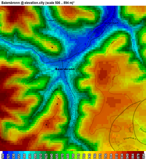
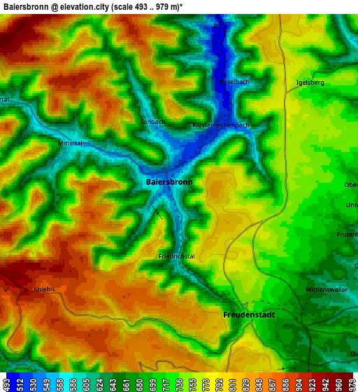
Below is the Elevation map of Baiersbronn, which displays elevation range with different colors. Scale of the first map is from 506 to 894 m (1660 to 2933 ft) with average elevation of 703.8 meters (=2309 ft) [note 1]
These maps also provides idea of topography and contour of this city, they are displayed at different zoom levels. More info about maps, scale and edge coordinates you can find below images.
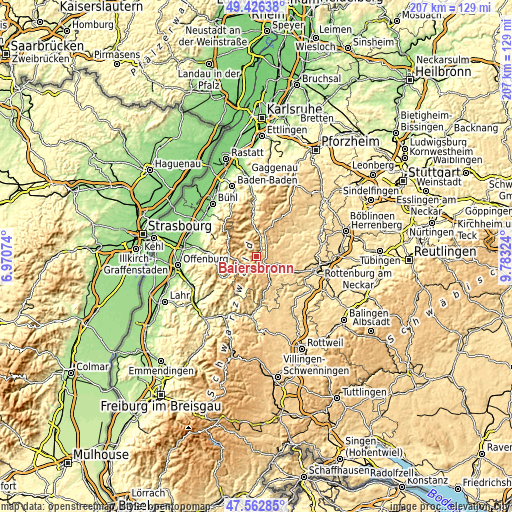
| \ | Map #1 | Map #2 | Topo.Map |
| Scale [m] | 506..894 m | 493..979 m | × |
| Scale [ft] | 1660..2933 ft | 1617..3212 ft | × |
| Average | 703.8 m = 2309 ft | 740.6 m = 2430 ft | × |
| Width | 6.48 km = 4 mi | 12.95 km = 8 mi | 207.2 km = 128.7 mi |
| Height | 6.48 km = 4 mi | 12.95 km = 8 mi | 207.2 km = 128.7 mi |
| ↑Max Latitude | 48.532289° | 48.561381° | 49.42638° |
| Latitude at center | 48.50318° | 48.50318° | 48.50318° |
| ↓Min Latitude | 48.474054° | 48.444912° | 47.56285° |
| ← Min Longitude | 8.333045° | 8.289099° | 6.97074° |
| Longitude center | 8.37699° | 8.37699° | 8.37699° |
| →Max Longitude | 8.420935° | 8.464881° | 9.78324° |
Nearby cities:
Cities around Baiersbronn sort by population:
• Freudenstadt elevation 736 m
4.9 km,  146°
146°
• Dornstetten 641 m
9.6 km,  111°
111°
• Pfalzgrafenweiler 634 m
14.1 km,  79°
79°
• Loßburg 655 m
12.7 km, 154°
• Oppenau 271 m
16.4 km,  258°
258°
• Biberach 731 m
14 km,  328°
328°
• Bad Peterstal-Griesbach 446 m
14.1 km,  236°
236°
• Schopfloch 666 m
13.9 km, 112°
• Glatten 560 m
12 km,  124°
124°
• Bad Rippoldsau-Schapbach 549 m
9.1 km,  204°
204°
• Simmersfeld 701 m
16.3 km,  39°
39°
• Seebach 400 m
17.2 km,  298°
298°
Multilingual:
 En español:
Baiersbronn elevación 598 m.
 En France:
Baiersbronn élévation 598 m.
 Auf Deutsch:
Baiersbronn höhe über dem Meeresspiegel ist 598 m.

Sources and notes:
- [note 1] Map square and city borders are not equal. Map elevation data is calculated only from area inside that square.
- [src 1] Elevation data from geonames database provided with same terms of usage.
- [src 2] The elevation map of Baiersbronn is generated using elevation data from NASA's 3 arcsec (90m) resolution SRTM data.
- [src 3] Base (background) map © OpenStreetMap contributors tiles are generated by Geofabrik and OpenTopoMap.
Copyright & License:
This Baiersbronn Elevation Map is licensed under CC BY-SA. You may reuse any part from this page, if you give a proper credit by linking to this URL:
 More info on terms of use page.