Epfendorf elevation
Epfendorf (Baden-Württemberg, Freiburg Region), Germany elevation is 482 meters and Epfendorf elevation in feet is 1581 ft above sea level [src 1]. Epfendorf is a seat of a fourth-order administrative division (feature code) with elevation that is 224 meters (735 ft) bigger than average city elevation in Germany.
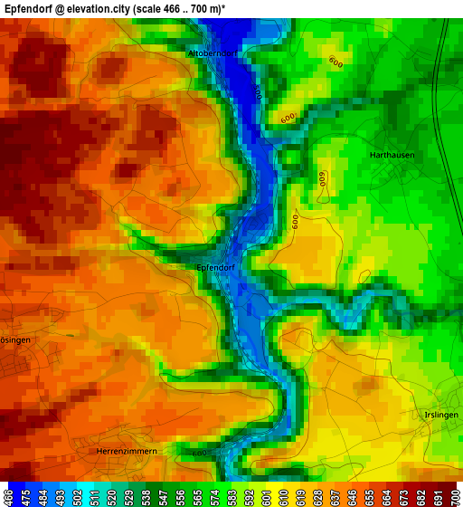
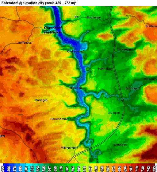
Below is the Elevation map of Epfendorf, which displays elevation range with different colors. Scale of the first map is from 466 to 700 m (1529 to 2297 ft) with average elevation of 602.1 meters (=1975 ft) [note 1]
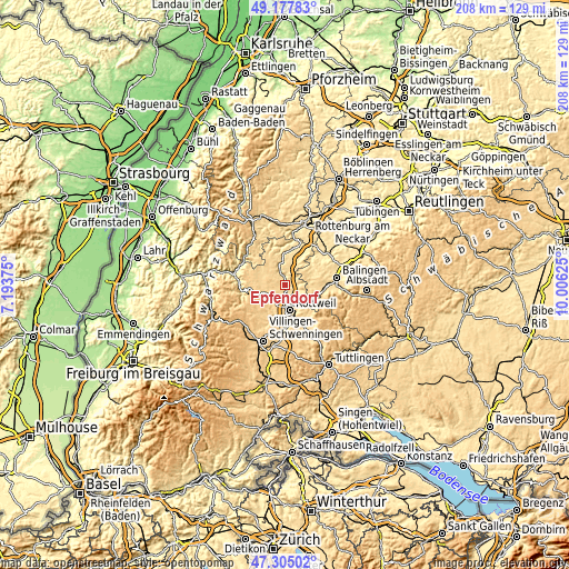
These maps also provides idea of topography and contour of this city, they are displayed at different zoom levels. More info about maps, scale and edge coordinates you can find below images.
| \ | Map #1 | Map #2 | Topo.Map |
| Scale [m] | 466..700 m | 455..753 m | × |
| Scale [ft] | 1529..2297 ft | 1493..2470 ft | × |
| Average | 602.1 m = 1975 ft | 626 m = 2054 ft | × |
| Width | 6.51 km = 4 mi | 13.01 km = 8.1 mi | 208.2 km = 129.4 mi |
| Height | 6.51 km = 4 mi | 13.01 km = 8.1 mi | 208.2 km = 129.4 mi |
| ↑Max Latitude | 48.279254° | 48.308491° | 49.17783° |
| Latitude at center | 48.25° | 48.25° | 48.25° |
| ↓Min Latitude | 48.220729° | 48.191442° | 47.30502° |
| ← Min Longitude | 8.556055° | 8.512109° | 7.19375° |
| Longitude center | 8.6° | 8.6° | 8.6° |
| →Max Longitude | 8.643945° | 8.687891° | 10.00625° |
Nearby cities:
Cities around Epfendorf sort by population:
• Rottweil elevation 605 m
9.4 km,  167°
167°
• Oberndorf 510 m
5 km,  335°
335°
• Sulz am Neckar 431 m
12.7 km,  11°
11°
• Rosenfeld 630 m
10 km,  66°
66°
• Zimmern ob Rottweil 663 m
9.3 km,  182°
182°
• Dunningen 659 m
8.1 km,  238°
238°
• Schömberg 677 m
12.6 km,  110°
110°
• Vöhringen 507 m
10.5 km,  26°
26°
• Dietingen 574 m
6.2 km,  144°
144°
• Bösingen 658 m
4.1 km, 243°
• Villingendorf 640 m
5.7 km,  192°
192°
• Seedorf 661 m
8.2 km,  269°
269°
Multilingual:
 En español:
Epfendorf elevación 482 m.
 En France:
Epfendorf élévation 482 m.
 Auf Deutsch:
Epfendorf höhe über dem Meeresspiegel ist 482 m.

Sources and notes:
- [note 1] Map square and city borders are not equal. Map elevation data is calculated only from area inside that square.
- [src 1] Elevation data from geonames database provided with same terms of usage.
- [src 2] The elevation map of Epfendorf is generated using elevation data from NASA's 3 arcsec (90m) resolution SRTM data.
- [src 3] Base (background) map © OpenStreetMap contributors tiles are generated by Geofabrik and OpenTopoMap.
Copyright & License:
This Epfendorf Elevation Map is licensed under CC BY-SA. You may reuse any part from this page, if you give a proper credit by linking to this URL:
 More info on terms of use page.