Fahrenbach elevation
Fahrenbach (Baden-Württemberg, Karlsruhe Region), Germany elevation is 367 meters and Fahrenbach elevation in feet is 1204 ft above sea level [src 1]. Fahrenbach is a seat of a fourth-order administrative division (feature code) with elevation that is 109 meters (358 ft) bigger than average city elevation in Germany.
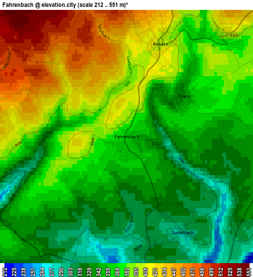
Below is the Elevation map of Fahrenbach, which displays elevation range with different colors. Scale of the first map is from 212 to 551 m (696 to 1808 ft) with average elevation of 372.2 meters (=1221 ft) [note 1]
These maps also provides idea of topography and contour of this city, they are displayed at different zoom levels. More info about maps, scale and edge coordinates you can find below images.
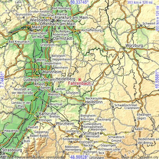
| \ | Map #1 | Topo.Map |
| Scale [m] | 212..551 m | × |
| Scale [ft] | 696..1808 ft | × |
| Average | 372.2 m = 1221 ft | × |
| Width | 6.36 km = 4 mi | 203.4 km = 126.4 mi |
| Height | 6.36 km = 4 mi | 203.4 km = 126.4 mi |
| ↑Max Latitude | 49.459962° | 50.33745° |
| Latitude at center | 49.43139° | 49.43139° |
| ↓Min Latitude | 49.402801° | 48.50828° |
| ← Min Longitude | 9.106615° | 7.74431° |
| Longitude center | 9.15056° | 9.15056° |
| →Max Longitude | 9.194505° | 10.55681° |
Nearby cities:
Cities around Fahrenbach sort by population:
• Mosbach elevation 186 m
8.7 km,  179°
179°
• Eberbach 144 m
12.2 km,  288°
288°
• Billigheim 251 m
11.9 km,  140°
140°
• Obrigheim 150 m
9.8 km,  206°
206°
• Mudau 452 m
12.1 km,  18°
18°
• Aglasterhausen 205 m
14.4 km,  235°
235°
• Haßmersheim 151 m
14.6 km, 180°
• Seckach 269 m
13.3 km,  84°
84°
• Neckargerach 133 m
7 km, 240°
• Neunkirchen 294 m
11.3 km, 243°
• Neckarzimmern 153 m
12.5 km,  185°
185°
• Binau 169 m
9.7 km,  223°
223°
Multilingual:
 En español:
Fahrenbach elevación 367 m.
 En France:
Fahrenbach élévation 367 m.
 Auf Deutsch:
Fahrenbach höhe über dem Meeresspiegel ist 367 m.

Sources and notes:
- [note 1] Map square and city borders are not equal. Map elevation data is calculated only from area inside that square.
- [src 1] Elevation data from geonames database provided with same terms of usage.
- [src 2] The elevation map of Fahrenbach is generated using elevation data from NASA's 3 arcsec (90m) resolution SRTM data.
- [src 3] Base (background) map © OpenStreetMap contributors tiles are generated by Geofabrik and OpenTopoMap.
Copyright & License:
This Fahrenbach Elevation Map is licensed under CC BY-SA. You may reuse any part from this page, if you give a proper credit by linking to this URL:
 More info on terms of use page.