Aglasterhausen elevation
Aglasterhausen (Baden-Württemberg, Karlsruhe Region), Germany elevation is 205 meters and Aglasterhausen elevation in feet is 673 ft above sea level [src 1]. Aglasterhausen is a seat of a fourth-order administrative division (feature code) with elevation that is 53 meters (174 ft) smaller than average city elevation in Germany.
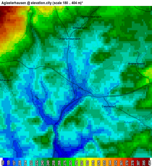
Below is the Elevation map of Aglasterhausen, which displays elevation range with different colors. Scale of the first map is from 180 to 404 m (591 to 1325 ft) with average elevation of 238.9 meters (=784 ft) [note 1]
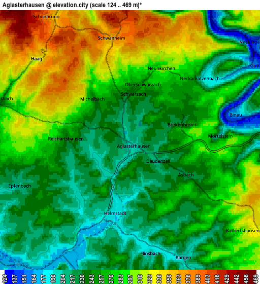
These maps also provides idea of topography and contour of this city, they are displayed at different zoom levels. More info about maps, scale and edge coordinates you can find below images.
| \ | Map #1 | Map #2 | Topo.Map |
| Scale [m] | 180..404 m | 124..469 m | × |
| Scale [ft] | 591..1325 ft | 407..1539 ft | × |
| Average | 238.9 m = 784 ft | 266.5 m = 874 ft | × |
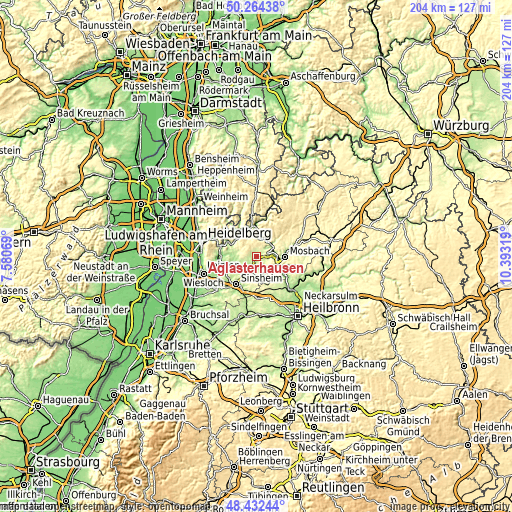
| Width | 6.37 km = 4 mi | 12.73 km = 7.9 mi | 203.7 km = 126.6 mi |
| Height | 6.37 km = 4 mi | 12.73 km = 7.9 mi | 203.7 km = 126.6 mi |
| ↑Max Latitude | 49.385555° | 49.414154° | 50.26438° |
| Latitude at center | 49.35694° | 49.35694° | 49.35694° |
| ↓Min Latitude | 49.328308° | 49.29966° | 48.43244° |
| ← Min Longitude | 8.942995° | 8.899049° | 7.58069° |
| Longitude center | 8.98694° | 8.98694° | 8.98694° |
| →Max Longitude | 9.030885° | 9.074831° | 10.39319° |
Nearby cities:
Cities around Aglasterhausen sort by population:
• Waibstadt elevation 182 m
8.5 km,  216°
216°
• Obrigheim 150 m
7.5 km,  94°
94°
• Neckarbischofsheim 187 m
7 km,  193°
193°
• Helmstadt-Bargen 193 m
4.8 km,  171°
171°
• Epfenbach 216 m
6.1 km,  250°
250°
• Neckargerach 133 m
7.5 km,  50°
50°
• Lobbach 220 m
7.4 km,  285°
285°
• Reichartshausen 224 m
3 km,  265°
265°
• Neidenstein 166 m
8.7 km,  238°
238°
• Neunkirchen 294 m
3.7 km,  27°
27°
• Spechbach 198 m
7.6 km,  261°
261°
• Binau 169 m
5.3 km,  76°
76°
Multilingual:
 En español:
Aglasterhausen elevación 205 m.
 En France:
Aglasterhausen élévation 205 m.
 Auf Deutsch:
Aglasterhausen höhe über dem Meeresspiegel ist 205 m.

Sources and notes:
- [note 1] Map square and city borders are not equal. Map elevation data is calculated only from area inside that square.
- [src 1] Elevation data from geonames database provided with same terms of usage.
- [src 2] The elevation map of Aglasterhausen is generated using elevation data from NASA's 3 arcsec (90m) resolution SRTM data.
- [src 3] Base (background) map © OpenStreetMap contributors tiles are generated by Geofabrik and OpenTopoMap.
Copyright & License:
This Aglasterhausen Elevation Map is licensed under CC BY-SA. You may reuse any part from this page, if you give a proper credit by linking to this URL:
 More info on terms of use page.