Görwihl elevation
Görwihl (Baden-Württemberg, Freiburg Region), Germany elevation is 685 meters and Görwihl elevation in feet is 2247 ft above sea level [src 1]. Görwihl is a seat of a fourth-order administrative division (feature code) with elevation that is 427 meters (1401 ft) bigger than average city elevation in Germany.
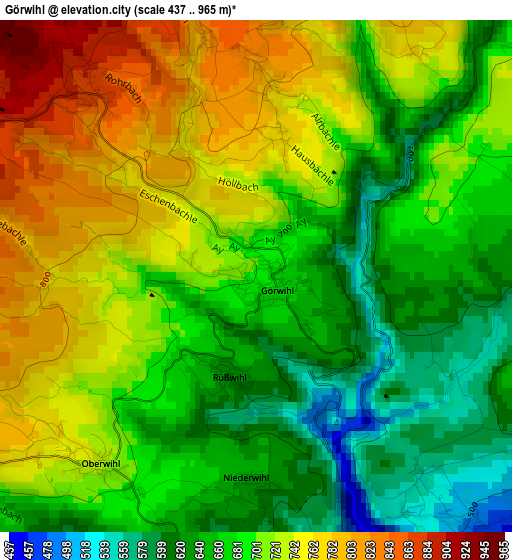
Below is the Elevation map of Görwihl, which displays elevation range with different colors. Scale of the first map is from 437 to 965 m (1434 to 3166 ft) with average elevation of 698.8 meters (=2293 ft) [note 1]
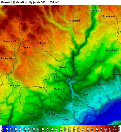
These maps also provides idea of topography and contour of this city, they are displayed at different zoom levels. More info about maps, scale and edge coordinates you can find below images.
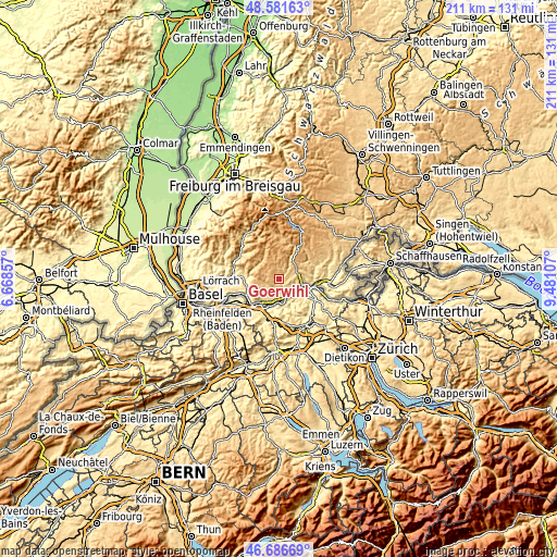
| \ | Map #1 | Map #2 | Topo.Map |
| Scale [m] | 437..965 m | 300..1038 m | × |
| Scale [ft] | 1434..3166 ft | 984..3406 ft | × |
| Average | 698.8 m = 2293 ft | 691.9 m = 2270 ft | × |
| Width | 6.58 km = 4.1 mi | 13.17 km = 8.2 mi | 210.7 km = 130.9 mi |
| Height | 6.58 km = 4.1 mi | 13.17 km = 8.2 mi | 210.7 km = 130.9 mi |
| ↑Max Latitude | 47.67235° | 47.701933° | 48.58163° |
| Latitude at center | 47.64275° | 47.64275° | 47.64275° |
| ↓Min Latitude | 47.613133° | 47.5835° | 46.68669° |
| ← Min Longitude | 8.030875° | 7.986929° | 6.66857° |
| Longitude center | 8.07482° | 8.07482° | 8.07482° |
| →Max Longitude | 8.118765° | 8.162711° | 9.48107° |
Nearby cities:
Cities around Görwihl sort by population:
• Waldshut-Tiengen elevation 341 m
10.9 km,  101°
101°
• Wehr 358 m
12.9 km,  263°
263°
• Laufenburg 341 m
8.7 km,  187°
187°
• Albbruck 315 m
7.1 km,  144°
144°
• Murg 308 m
10.5 km,  202°
202°
• Rickenbach 725 m
7.7 km,  249°
249°
• Weilheim 669 m
12.2 km,  77°
77°
• Herrischried 882 m
6.2 km,  295°
295°
• Höchenschwand 994 m
12.2 km,  34°
34°
• Dogern 326 m
7.8 km,  118°
118°
• Todtmoos 809 m
12.1 km,  333°
333°
• Hasel 401 m
13.4 km,  275°
275°
Multilingual:
 En español:
Görwihl elevación 685 m.
 En France:
Görwihl élévation 685 m.


Sources and notes:
- [note 1] Map square and city borders are not equal. Map elevation data is calculated only from area inside that square.
- [src 1] Elevation data from geonames database provided with same terms of usage.
- [src 2] The elevation map of Görwihl is generated using elevation data from NASA's 3 arcsec (90m) resolution SRTM data.
- [src 3] Base (background) map © OpenStreetMap contributors tiles are generated by Geofabrik and OpenTopoMap.
Copyright & License:
This Görwihl Elevation Map is licensed under CC BY-SA. You may reuse any part from this page, if you give a proper credit by linking to this URL:
 More info on terms of use page.