Todtmoos elevation
Todtmoos (Baden-Württemberg, Freiburg Region), Germany elevation is 809 meters and Todtmoos elevation in feet is 2654 ft above sea level [src 1]. Todtmoos is a seat of a fourth-order administrative division (feature code) with elevation that is 551 meters (1808 ft) bigger than average city elevation in Germany.
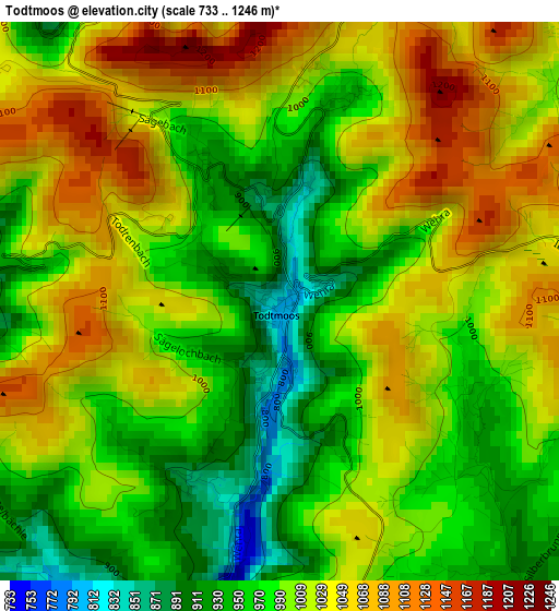
Below is the Elevation map of Todtmoos, which displays elevation range with different colors. Scale of the first map is from 733 to 1246 m (2405 to 4088 ft) with average elevation of 1006.4 meters (=3302 ft) [note 1]
These maps also provides idea of topography and contour of this city, they are displayed at different zoom levels. More info about maps, scale and edge coordinates you can find below images.
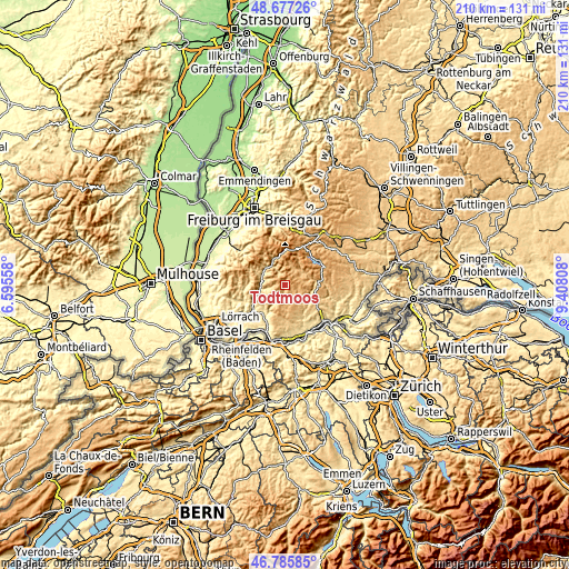
| \ | Map #1 | Topo.Map |
| Scale [m] | 733..1246 m | × |
| Scale [ft] | 2405..4088 ft | × |
| Average | 1006.4 m = 3302 ft | × |
| Width | 6.57 km = 4.1 mi | 210.3 km = 130.7 mi |
| Height | 6.57 km = 4.1 mi | 210.3 km = 130.7 mi |
| ↑Max Latitude | 47.769685° | 48.67726° |
| Latitude at center | 47.74014° | 47.74014° |
| ↓Min Latitude | 47.710579° | 46.78585° |
| ← Min Longitude | 7.957885° | 6.59558° |
| Longitude center | 8.00183° | 8.00183° |
| →Max Longitude | 8.045775° | 9.40808° |
Nearby cities:
Cities around Todtmoos sort by population:
• Zell im Wiesental elevation 431 m
11.8 km,  251°
251°
• Todtnau 642 m
10.8 km,  336°
336°
• Görwihl 685 m
12.1 km,  153°
153°
• Sankt Blasien 765 m
9.7 km,  75°
75°
• Rickenbach 725 m
13.6 km,  187°
187°
• Herrischried 882 m
8.2 km,  180°
180°
• Schönau im Schwarzwald 535 m
9.5 km,  302°
302°
• Höchenschwand 994 m
12.3 km,  93°
93°
• Hausen 406 m
13.8 km,  241°
241°
• Bernau 916 m
7.2 km,  22°
22°
• Häusern 886 m
12.4 km, 84°
• Hasel 401 m
12.4 km,  219°
219°
Multilingual:
 En español:
Todtmoos elevación 809 m.
 En France:
Todtmoos élévation 809 m.
 Auf Deutsch:
Todtmoos höhe über dem Meeresspiegel ist 809 m.

Sources and notes:
- [note 1] Map square and city borders are not equal. Map elevation data is calculated only from area inside that square.
- [src 1] Elevation data from geonames database provided with same terms of usage.
- [src 2] The elevation map of Todtmoos is generated using elevation data from NASA's 3 arcsec (90m) resolution SRTM data.
- [src 3] Base (background) map © OpenStreetMap contributors tiles are generated by Geofabrik and OpenTopoMap.
Copyright & License:
This Todtmoos Elevation Map is licensed under CC BY-SA. You may reuse any part from this page, if you give a proper credit by linking to this URL:
 More info on terms of use page.