Todtnau elevation
Todtnau (Baden-Württemberg, Freiburg Region), Germany elevation is 642 meters and Todtnau elevation in feet is 2106 ft above sea level [src 1]. Todtnau is a populated place (feature code) with elevation that is 384 meters (1260 ft) bigger than average city elevation in Germany.
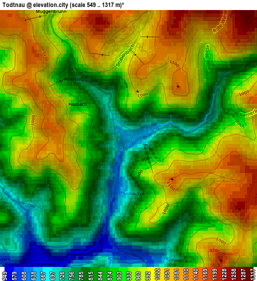
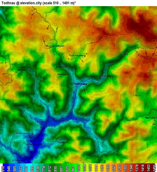
Below is the Elevation map of Todtnau, which displays elevation range with different colors. Scale of the first map is from 549 to 1317 m (1801 to 4321 ft) with average elevation of 930.5 meters (=3053 ft) [note 1]
These maps also provides idea of topography and contour of this city, they are displayed at different zoom levels. More info about maps, scale and edge coordinates you can find below images.
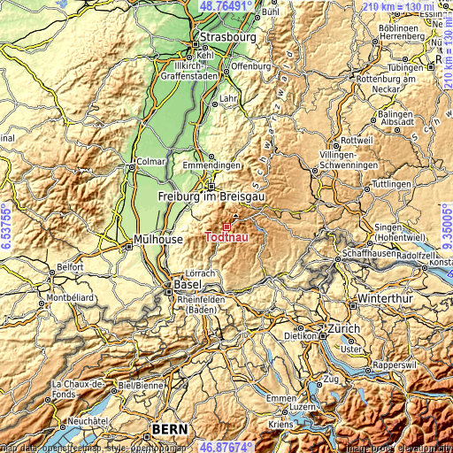
| \ | Map #1 | Map #2 | Topo.Map |
| Scale [m] | 549..1317 m | 510..1491 m | × |
| Scale [ft] | 1801..4321 ft | 1673..4892 ft | × |
| Average | 930.5 m = 3053 ft | 1001.5 m = 3286 ft | × |
| Width | 6.56 km = 4.1 mi | 13.12 km = 8.2 mi | 209.9 km = 130.4 mi |
| Height | 6.56 km = 4.1 mi | 13.12 km = 8.2 mi | 209.9 km = 130.4 mi |
| ↑Max Latitude | 47.858904° | 47.888381° | 48.76491° |
| Latitude at center | 47.82941° | 47.82941° | 47.82941° |
| ↓Min Latitude | 47.799899° | 47.770372° | 46.87674° |
| ← Min Longitude | 7.899855° | 7.855909° | 6.53755° |
| Longitude center | 7.9438° | 7.9438° | 7.9438° |
| →Max Longitude | 7.987745° | 8.031691° | 9.35005° |
Nearby cities:
Cities around Todtnau sort by population:
• Kirchzarten elevation 376 m
15.3 km,  1°
1°
• Zell im Wiesental 431 m
15.4 km,  206°
206°
• Münstertal/Schwarzwald 381 m
12.2 km,  283°
283°
• Buchenbach 449 m
15.5 km,  18°
18°
• Oberried 460 m
11.6 km, 2°
• Hinterzarten 895 m
14.7 km,  56°
56°
• Schönau im Schwarzwald 535 m
6.1 km,  217°
217°
• Bollschweil 327 m
15.4 km,  311°
311°
• Todtmoos 809 m
10.8 km,  156°
156°
• Bernau 916 m
7.8 km,  114°
114°
• Sölden 435 m
14.9 km,  320°
320°
• Horben 495 m
12.9 km,  333°
333°
Multilingual:
 En español:
Todtnau elevación 642 m.
 En France:
Todtnau élévation 642 m.


Sources and notes:
- [note 1] Map square and city borders are not equal. Map elevation data is calculated only from area inside that square.
- [src 1] Elevation data from geonames database provided with same terms of usage.
- [src 2] The elevation map of Todtnau is generated using elevation data from NASA's 3 arcsec (90m) resolution SRTM data.
- [src 3] Base (background) map © OpenStreetMap contributors tiles are generated by Geofabrik and OpenTopoMap.
Copyright & License:
This Todtnau Elevation Map is licensed under CC BY-SA. You may reuse any part from this page, if you give a proper credit by linking to this URL:
 More info on terms of use page.