Kirchzarten elevation
Kirchzarten (Baden-Württemberg, Freiburg Region), Germany elevation is 376 meters and Kirchzarten elevation in feet is 1234 ft above sea level [src 1]. Kirchzarten is a seat of a fourth-order administrative division (feature code) with elevation that is 118 meters (387 ft) bigger than average city elevation in Germany.
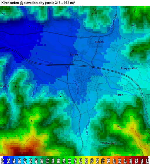
Below is the Elevation map of Kirchzarten, which displays elevation range with different colors. Scale of the first map is from 317 to 972 m (1040 to 3189 ft) with average elevation of 457.8 meters (=1502 ft) [note 1]
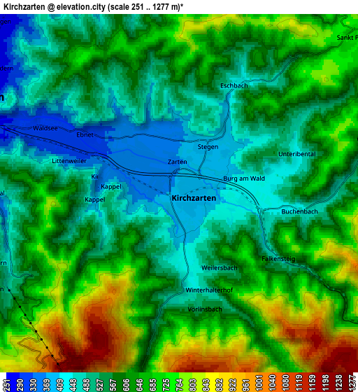
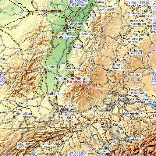
These maps also provides idea of topography and contour of this city, they are displayed at different zoom levels. More info about maps, scale and edge coordinates you can find below images.
| \ | Map #1 | Map #2 | Topo.Map |
| Scale [m] | 317..972 m | 251..1277 m | × |
| Scale [ft] | 1040..3189 ft | 823..4190 ft | × |
| Average | 457.8 m = 1502 ft | 607.7 m = 1994 ft | × |
| Width | 6.54 km = 4.1 mi | 13.09 km = 8.1 mi | 209.4 km = 130.1 mi |
| Height | 6.54 km = 4.1 mi | 13.09 km = 8.1 mi | 209.4 km = 130.1 mi |
| ↑Max Latitude | 47.996086° | 48.025485° | 48.89967° |
| Latitude at center | 47.96667° | 47.96667° | 47.96667° |
| ↓Min Latitude | 47.937237° | 47.907788° | 47.01651° |
| ← Min Longitude | 7.906055° | 7.862109° | 6.54375° |
| Longitude center | 7.95° | 7.95° | 7.95° |
| →Max Longitude | 7.993945° | 8.037891° | 9.35625° |
Nearby cities:
Cities around Kirchzarten sort by population:
• Freiburg elevation 279 m
8 km,  294°
294°
• Gundelfingen 235 m
10.5 km,  323°
323°
• Merzhausen 351 m
8.7 km,  270°
270°
• Stegen 386 m
2.2 km,  33°
33°
• Buchenbach 449 m
4.4 km,  97°
97°
• Oberried 460 m
3.7 km,  180°
180°
• Sankt Peter 715 m
8.2 km,  49°
49°
• Breitnau 968 m
10.6 km,  110°
110°
• Wittnau 377 m
10.1 km,  259°
259°
• Au 367 m
8.9 km, 257°
• Sölden 435 m
10.6 km,  249°
249°
• Horben 495 m
7.2 km,  239°
239°
Multilingual:
 En español:
Kirchzarten elevación 376 m.
 En France:
Kirchzarten élévation 376 m.
 Auf Deutsch:
Kirchzarten höhe über dem Meeresspiegel ist 376 m.

Sources and notes:
- [note 1] Map square and city borders are not equal. Map elevation data is calculated only from area inside that square.
- [src 1] Elevation data from geonames database provided with same terms of usage.
- [src 2] The elevation map of Kirchzarten is generated using elevation data from NASA's 3 arcsec (90m) resolution SRTM data.
- [src 3] Base (background) map © OpenStreetMap contributors tiles are generated by Geofabrik and OpenTopoMap.
Copyright & License:
This Kirchzarten Elevation Map is licensed under CC BY-SA. You may reuse any part from this page, if you give a proper credit by linking to this URL:
 More info on terms of use page.