Hollfeld elevation
Hollfeld (Bavaria, Upper Franconia), Germany elevation is 405 meters and Hollfeld elevation in feet is 1329 ft above sea level [src 1]. Hollfeld is a populated place (feature code) with elevation that is 147 meters (482 ft) bigger than average city elevation in Germany.
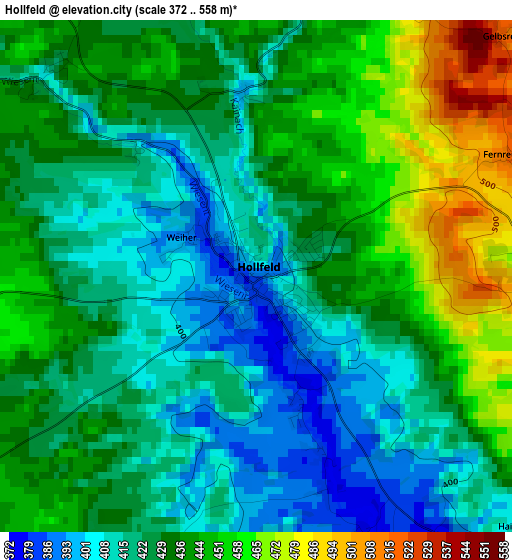
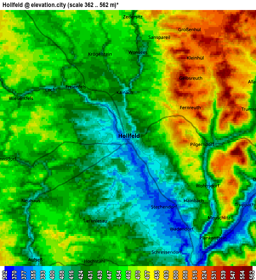
Below is the Elevation map of Hollfeld, which displays elevation range with different colors. Scale of the first map is from 372 to 558 m (1220 to 1831 ft) with average elevation of 430.4 meters (=1412 ft) [note 1]
These maps also provides idea of topography and contour of this city, they are displayed at different zoom levels. More info about maps, scale and edge coordinates you can find below images.
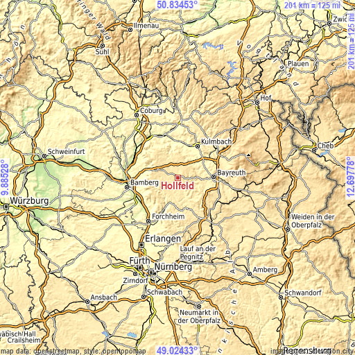
| \ | Map #1 | Map #2 | Topo.Map |
| Scale [m] | 372..558 m | 362..562 m | × |
| Scale [ft] | 1220..1831 ft | 1188..1844 ft | × |
| Average | 430.4 m = 1412 ft | 449.5 m = 1475 ft | × |
| Width | 6.29 km = 3.9 mi | 12.58 km = 7.8 mi | 201.3 km = 125.1 mi |
| Height | 6.29 km = 3.9 mi | 12.58 km = 7.8 mi | 201.3 km = 125.1 mi |
| ↑Max Latitude | 49.966206° | 49.994465° | 50.83453° |
| Latitude at center | 49.93793° | 49.93793° | 49.93793° |
| ↓Min Latitude | 49.909638° | 49.881329° | 49.02433° |
| ← Min Longitude | 11.247585° | 11.203639° | 9.88528° |
| Longitude center | 11.29153° | 11.29153° | 11.29153° |
| →Max Longitude | 11.335475° | 11.379421° | 12.69778° |
Nearby cities:
Cities around Hollfeld sort by population:
• Eckersdorf elevation 352 m
12.6 km,  36°
36°
• Thurnau 361 m
12.2 km, 36°
• Mistelgau 438 m
12.8 km,  102°
102°
• Heiligenstadt 356 m
12 km,  225°
225°
• Waischenfeld 365 m
10.9 km,  158°
158°
• Kasendorf 381 m
11.8 km,  21°
21°
• Glashütten 423 m
12.6 km,  116°
116°
• Poxdorf 501 m
12.1 km,  269°
269°
• Aufseß 411 m
7.6 km,  217°
217°
• Königsfeld 450 m
9.1 km,  275°
275°
• Stadelhofen 480 m
9.9 km,  317°
317°
• Wonsees 416 m
4.3 km,  8°
8°
Multilingual:
 En español:
Hollfeld elevación 405 m.
 En France:
Hollfeld élévation 405 m.
 Auf Deutsch:
Hollfeld höhe über dem Meeresspiegel ist 405 m.

Sources and notes:
- [note 1] Map square and city borders are not equal. Map elevation data is calculated only from area inside that square.
- [src 1] Elevation data from geonames database provided with same terms of usage.
- [src 2] The elevation map of Hollfeld is generated using elevation data from NASA's 3 arcsec (90m) resolution SRTM data.
- [src 3] Base (background) map © OpenStreetMap contributors tiles are generated by Geofabrik and OpenTopoMap.
Copyright & License:
This Hollfeld Elevation Map is licensed under CC BY-SA. You may reuse any part from this page, if you give a proper credit by linking to this URL:
 More info on terms of use page.