Stadelhofen elevation
Stadelhofen (Bavaria, Upper Franconia), Germany elevation is 480 meters and Stadelhofen elevation in feet is 1575 ft above sea level [src 1]. Stadelhofen is a seat of a fourth-order administrative division (feature code) with elevation that is 222 meters (728 ft) bigger than average city elevation in Germany.
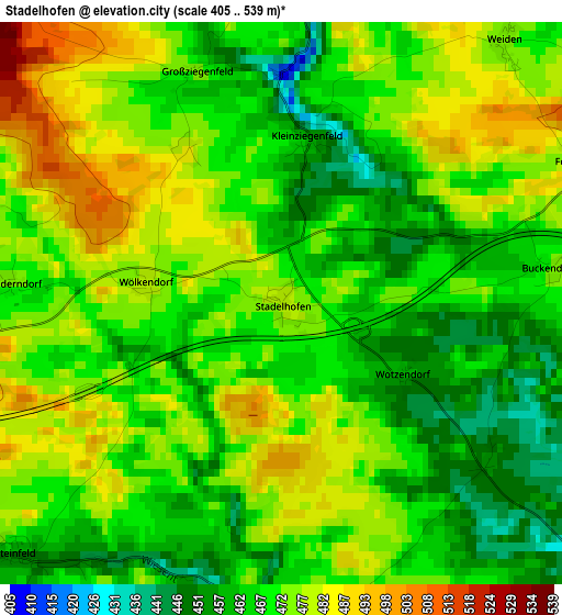
Below is the Elevation map of Stadelhofen, which displays elevation range with different colors. Scale of the first map is from 405 to 539 m (1329 to 1768 ft) with average elevation of 470.5 meters (=1544 ft) [note 1]
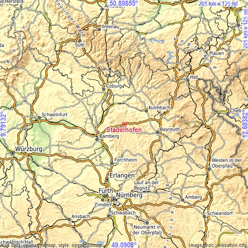
These maps also provides idea of topography and contour of this city, they are displayed at different zoom levels. More info about maps, scale and edge coordinates you can find below images.
| \ | Map #1 | Topo.Map |
| Scale [m] | 405..539 m | × |
| Scale [ft] | 1329..1768 ft | × |
| Average | 470.5 m = 1544 ft | × |
| Width | 6.28 km = 3.9 mi | 201 km = 124.9 mi |
| Height | 6.28 km = 3.9 mi | 201 km = 124.9 mi |
| ↑Max Latitude | 50.031407° | 50.89855° |
| Latitude at center | 50.00317° | 50.00317° |
| ↓Min Latitude | 49.974916° | 49.0908° |
| ← Min Longitude | 11.153625° | 9.79132° |
| Longitude center | 11.19757° | 11.19757° |
| →Max Longitude | 11.241515° | 12.60382° |
Nearby cities:
Cities around Stadelhofen sort by population:
• Scheßlitz elevation 307 m
12.2 km,  255°
255°
• Altenkunstadt 289 m
14.1 km,  15°
15°
• Hollfeld 405 m
9.9 km,  137°
137°
• Eckersdorf 352 m
14.5 km,  78°
78°
• Weismain 318 m
9.6 km, 18°
• Thurnau 361 m
14.2 km, 79°
• Kasendorf 381 m
11.6 km,  71°
71°
• Altendorf 461 m
9.3 km,  346°
346°
• Poxdorf 501 m
9.2 km,  216°
216°
• Aufseß 411 m
13.4 km,  171°
171°
• Königsfeld 450 m
6.8 km,  200°
200°
• Wonsees 416 m
7.9 km,  112°
112°
Multilingual:
 En español:
Stadelhofen elevación 480 m.
 En France:
Stadelhofen élévation 480 m.
 Auf Deutsch:
Stadelhofen höhe über dem Meeresspiegel ist 480 m.

Sources and notes:
- [note 1] Map square and city borders are not equal. Map elevation data is calculated only from area inside that square.
- [src 1] Elevation data from geonames database provided with same terms of usage.
- [src 2] The elevation map of Stadelhofen is generated using elevation data from NASA's 3 arcsec (90m) resolution SRTM data.
- [src 3] Base (background) map © OpenStreetMap contributors tiles are generated by Geofabrik and OpenTopoMap.
Copyright & License:
This Stadelhofen Elevation Map is licensed under CC BY-SA. You may reuse any part from this page, if you give a proper credit by linking to this URL:
 More info on terms of use page.