Inzell elevation
Inzell (Bavaria, Upper Bavaria), Germany elevation is 696 meters and Inzell elevation in feet is 2283 ft above sea level [src 1]. Inzell is a seat of a fourth-order administrative division (feature code) with elevation that is 438 meters (1437 ft) bigger than average city elevation in Germany.
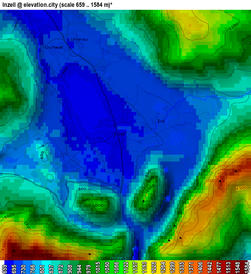
Below is the Elevation map of Inzell, which displays elevation range with different colors. Scale of the first map is from 659 to 1584 m (2162 to 5197 ft) with average elevation of 879.7 meters (=2886 ft) [note 1]
These maps also provides idea of topography and contour of this city, they are displayed at different zoom levels. More info about maps, scale and edge coordinates you can find below images.
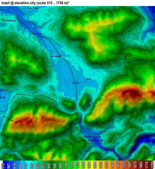
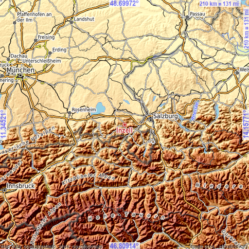
| \ | Map #1 | Map #2 | Topo.Map |
| Scale [m] | 659..1584 m | 519..1758 m | × |
| Scale [ft] | 2162..5197 ft | 1703..5768 ft | × |
| Average | 879.7 m = 2886 ft | 915.3 m = 3003 ft | × |
| Width | 6.57 km = 4.1 mi | 13.14 km = 8.2 mi | 210.2 km = 130.6 mi |
| Height | 6.57 km = 4.1 mi | 13.14 km = 8.2 mi | 210.2 km = 130.6 mi |
| ↑Max Latitude | 47.792552° | 47.822066° | 48.69972° |
| Latitude at center | 47.76302° | 47.76302° | 47.76302° |
| ↓Min Latitude | 47.733472° | 47.703906° | 46.80914° |
| ← Min Longitude | 12.707515° | 12.663569° | 11.34521° |
| Longitude center | 12.75146° | 12.75146° | 12.75146° |
| →Max Longitude | 12.795405° | 12.839351° | 14.15771° |
Nearby cities:
Cities around Inzell sort by population:
• Traunstein elevation 597 m
14.2 km,  325°
325°
• Bad Reichenhall 470 m
10.2 km,  111°
111°
• Ainring 439 m
15.2 km,  68°
68°
• Teisendorf 498 m
10.8 km,  27°
27°
• Siegsdorf 605 m
10.5 km,  309°
309°
• Ruhpolding 648 m
7.6 km,  273°
273°
• Piding 449 m
12.4 km,  88°
88°
• Bergen 548 m
13.1 km,  292°
292°
• Surberg 599 m
12.1 km,  341°
341°
• Bayerisch Gmain 553 m
12.2 km, 114°
• Vachendorf 577 m
14 km, 309°
• Schneizlreuth 651 m
9.6 km,  157°
157°
Multilingual:
 En español:
Inzell elevación 696 m.
 En France:
Inzell élévation 696 m.


Sources and notes:
- [note 1] Map square and city borders are not equal. Map elevation data is calculated only from area inside that square.
- [src 1] Elevation data from geonames database provided with same terms of usage.
- [src 2] The elevation map of Inzell is generated using elevation data from NASA's 3 arcsec (90m) resolution SRTM data.
- [src 3] Base (background) map © OpenStreetMap contributors tiles are generated by Geofabrik and OpenTopoMap.
Copyright & License:
This Inzell Elevation Map is licensed under CC BY-SA. You may reuse any part from this page, if you give a proper credit by linking to this URL:
 More info on terms of use page.