Siegsdorf elevation
Siegsdorf (Bavaria, Upper Bavaria), Germany elevation is 605 meters and Siegsdorf elevation in feet is 1985 ft above sea level [src 1]. Siegsdorf is a seat of a fourth-order administrative division (feature code) with elevation that is 347 meters (1138 ft) bigger than average city elevation in Germany.
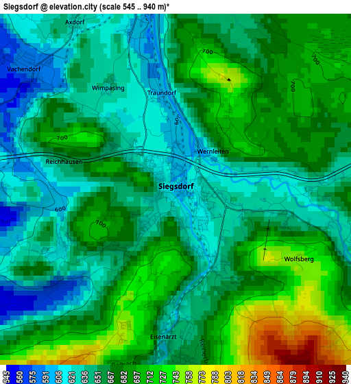
Below is the Elevation map of Siegsdorf, which displays elevation range with different colors. Scale of the first map is from 545 to 940 m (1788 to 3084 ft) with average elevation of 666.3 meters (=2186 ft) [note 1]
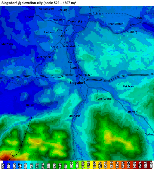
These maps also provides idea of topography and contour of this city, they are displayed at different zoom levels. More info about maps, scale and edge coordinates you can find below images.
| \ | Map #1 | Map #2 | Topo.Map |
| Scale [m] | 545..940 m | 522..1607 m | × |
| Scale [ft] | 1788..3084 ft | 1713..5272 ft | × |
| Average | 666.3 m = 2186 ft | 703.4 m = 2308 ft | × |
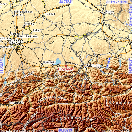
| Width | 6.56 km = 4.1 mi | 13.12 km = 8.2 mi | 210 km = 130.5 mi |
| Height | 6.56 km = 4.1 mi | 13.12 km = 8.2 mi | 210 km = 130.5 mi |
| ↑Max Latitude | 47.852278° | 47.881759° | 48.7584° |
| Latitude at center | 47.82278° | 47.82278° | 47.82278° |
| ↓Min Latitude | 47.793266° | 47.763734° | 46.86999° |
| ← Min Longitude | 12.598825° | 12.554879° | 11.23652° |
| Longitude center | 12.64277° | 12.64277° | 12.64277° |
| →Max Longitude | 12.686715° | 12.730661° | 14.04902° |
Nearby cities:
Cities around Siegsdorf sort by population:
• Traunstein elevation 597 m
5.1 km,  0°
0°
• Ruhpolding 648 m
6.3 km,  175°
175°
• Übersee 525 m
11.9 km,  266°
266°
• Bergen 548 m
4.3 km,  247°
247°
• Chieming 532 m
10.9 km,  315°
315°
• Inzell 696 m
10.5 km,  129°
129°
• Grabenstätt 522 m
7.8 km,  288°
288°
• Surberg 599 m
6.5 km,  41°
41°
• Nußdorf 597 m
9.8 km,  339°
339°
• Vachendorf 577 m
3.5 km,  308°
308°
• Sankt Leonhard am Wonneberg 588 m
11.8 km,  29°
29°
• Staudach-Egerndach 531 m
12.7 km, 249°
Multilingual:
 En español:
Siegsdorf elevación 605 m.
 En France:
Siegsdorf élévation 605 m.
 Auf Deutsch:
Siegsdorf höhe über dem Meeresspiegel ist 605 m.

Sources and notes:
- [note 1] Map square and city borders are not equal. Map elevation data is calculated only from area inside that square.
- [src 1] Elevation data from geonames database provided with same terms of usage.
- [src 2] The elevation map of Siegsdorf is generated using elevation data from NASA's 3 arcsec (90m) resolution SRTM data.
- [src 3] Base (background) map © OpenStreetMap contributors tiles are generated by Geofabrik and OpenTopoMap.
Copyright & License:
This Siegsdorf Elevation Map is licensed under CC BY-SA. You may reuse any part from this page, if you give a proper credit by linking to this URL:
 More info on terms of use page.