Chieming elevation
Chieming (Bavaria, Upper Bavaria), Germany elevation is 532 meters and Chieming elevation in feet is 1745 ft above sea level [src 1]. Chieming is a seat of a fourth-order administrative division (feature code) with elevation that is 274 meters (899 ft) bigger than average city elevation in Germany.
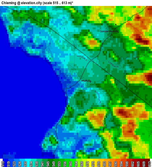
Below is the Elevation map of Chieming, which displays elevation range with different colors. Scale of the first map is from 515 to 613 m (1690 to 2011 ft) with average elevation of 539.8 meters (=1771 ft) [note 1]
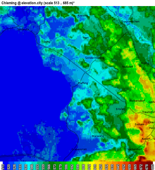
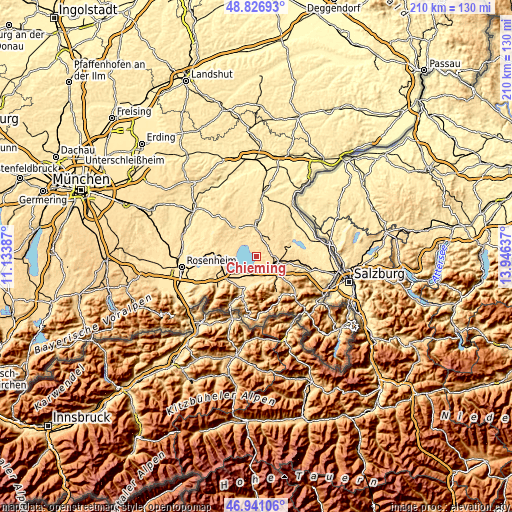
These maps also provides idea of topography and contour of this city, they are displayed at different zoom levels. More info about maps, scale and edge coordinates you can find below images.
| \ | Map #1 | Map #2 | Topo.Map |
| Scale [m] | 515..613 m | 513..685 m | × |
| Scale [ft] | 1690..2011 ft | 1683..2247 ft | × |
| Average | 539.8 m = 1771 ft | 547.1 m = 1795 ft | × |
| Width | 6.55 km = 4.1 mi | 13.11 km = 8.1 mi | 209.7 km = 130.3 mi |
| Height | 6.55 km = 4.1 mi | 13.11 km = 8.1 mi | 209.7 km = 130.3 mi |
| ↑Max Latitude | 47.922038° | 47.951479° | 48.82693° |
| Latitude at center | 47.89258° | 47.89258° | 47.89258° |
| ↓Min Latitude | 47.863105° | 47.833614° | 46.94106° |
| ← Min Longitude | 12.496175° | 12.452229° | 11.13387° |
| Longitude center | 12.54012° | 12.54012° | 12.54012° |
| →Max Longitude | 12.584065° | 12.628011° | 13.94637° |
Nearby cities:
Cities around Chieming sort by population:
• Traunreut elevation 552 m
8.7 km,  26°
26°
• Traunstein 597 m
8.2 km,  109°
109°
• Siegsdorf 605 m
10.9 km,  135°
135°
• Übersee 525 m
9.4 km,  206°
206°
• Bergen 548 m
10.1 km,  158°
158°
• Seeon-Seebruck 574 m
9.9 km,  326°
326°
• Grabenstätt 522 m
5.3 km,  177°
177°
• Surberg 599 m
12.3 km,  103°
103°
• Eggstätt 538 m
12.6 km,  287°
287°
• Nußdorf 597 m
4.4 km,  70°
70°
• Vachendorf 577 m
7.4 km, 138°
• Gstadt am Chiemsee 524 m
9.1 km,  264°
264°
Multilingual:
 En español:
Chieming elevación 532 m.
 En France:
Chieming élévation 532 m.
 Auf Deutsch:
Chieming höhe über dem Meeresspiegel ist 532 m.

Sources and notes:
- [note 1] Map square and city borders are not equal. Map elevation data is calculated only from area inside that square.
- [src 1] Elevation data from geonames database provided with same terms of usage.
- [src 2] The elevation map of Chieming is generated using elevation data from NASA's 3 arcsec (90m) resolution SRTM data.
- [src 3] Base (background) map © OpenStreetMap contributors tiles are generated by Geofabrik and OpenTopoMap.
Copyright & License:
This Chieming Elevation Map is licensed under CC BY-SA. You may reuse any part from this page, if you give a proper credit by linking to this URL:
 More info on terms of use page.