Kaltenwestheim elevation
Kaltenwestheim (Thuringia), Germany elevation is 501 meters and Kaltenwestheim elevation in feet is 1644 ft above sea level [src 1]. Kaltenwestheim is a seat of a fourth-order administrative division (feature code) with elevation that is 243 meters (797 ft) bigger than average city elevation in Germany.
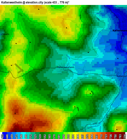
Below is the Elevation map of Kaltenwestheim, which displays elevation range with different colors. Scale of the first map is from 433 to 776 m (1421 to 2546 ft) with average elevation of 564.7 meters (=1853 ft) [note 1]
These maps also provides idea of topography and contour of this city, they are displayed at different zoom levels. More info about maps, scale and edge coordinates you can find below images.
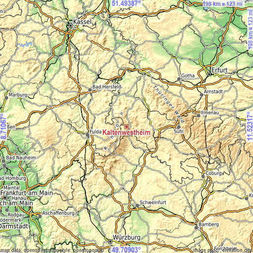
| \ | Map #1 | Topo.Map |
| Scale [m] | 433..776 m | × |
| Scale [ft] | 1421..2546 ft | × |
| Average | 564.7 m = 1853 ft | × |
| Width | 6.2 km = 3.9 mi | 198.5 km = 123.3 mi |
| Height | 6.2 km = 3.9 mi | 198.4 km = 123.3 mi |
| ↑Max Latitude | 50.637789° | 51.49387° |
| Latitude at center | 50.60991° | 50.60991° |
| ↓Min Latitude | 50.582014° | 49.70903° |
| ← Min Longitude | 10.072975° | 8.71067° |
| Longitude center | 10.11692° | 10.11692° |
| →Max Longitude | 10.160865° | 11.52317° |
Nearby cities:
Cities around Kaltenwestheim sort by population:
• Hilders elevation 450 m
9.1 km,  242°
242°
• Tann 385 m
7.5 km,  299°
299°
• Wasungen 273 m
18.7 km,  72°
72°
• Ostheim vor der Rhön 313 m
18.5 km,  154°
154°
• Geisa 293 m
16.5 km,  314°
314°
• Dermbach 370 m
11.6 km,  0°
0°
• Fladungen 414 m
10.1 km,  168°
168°
• Walldorf 275 m
18.8 km,  87°
87°
• Kaltennordheim 440 m
3.5 km,  58°
58°
• Frankenheim 757 m
8 km,  205°
205°
• Schleid 335 m
14.6 km, 313°
• Sondheim vor der Rhön 358 m
16.3 km, 170°
Multilingual:
 En español:
Kaltenwestheim elevación 501 m.
 En France:
Kaltenwestheim élévation 501 m.
 Auf Deutsch:
Kaltenwestheim höhe über dem Meeresspiegel ist 501 m.

Sources and notes:
- [note 1] Map square and city borders are not equal. Map elevation data is calculated only from area inside that square.
- [src 1] Elevation data from geonames database provided with same terms of usage.
- [src 2] The elevation map of Kaltenwestheim is generated using elevation data from NASA's 3 arcsec (90m) resolution SRTM data.
- [src 3] Base (background) map © OpenStreetMap contributors tiles are generated by Geofabrik and OpenTopoMap.
Copyright & License:
This Kaltenwestheim Elevation Map is licensed under CC BY-SA. You may reuse any part from this page, if you give a proper credit by linking to this URL:
 More info on terms of use page.