Geisa elevation
Geisa (Thuringia), Germany elevation is 293 meters and Geisa elevation in feet is 961 ft above sea level [src 1]. Geisa is a populated place (feature code) with elevation that is 35 meters (115 ft) bigger than average city elevation in Germany.
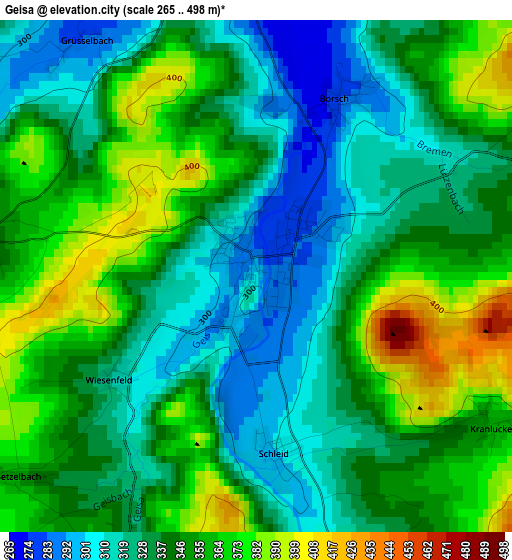
Below is the Elevation map of Geisa, which displays elevation range with different colors. Scale of the first map is from 265 to 498 m (869 to 1634 ft) with average elevation of 342.4 meters (=1123 ft) [note 1]
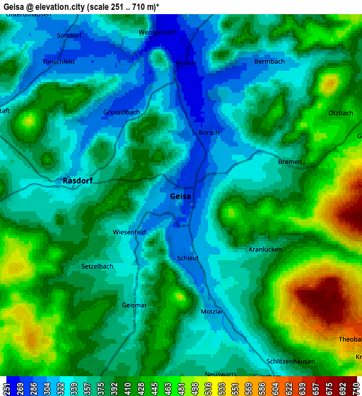
These maps also provides idea of topography and contour of this city, they are displayed at different zoom levels. More info about maps, scale and edge coordinates you can find below images.
| \ | Map #1 | Map #2 | Topo.Map |
| Scale [m] | 265..498 m | 251..710 m | × |
| Scale [ft] | 869..1634 ft | 823..2329 ft | × |
| Average | 342.4 m = 1123 ft | 386.3 m = 1267 ft | × |
| Width | 6.19 km = 3.8 mi | 12.38 km = 7.7 mi | 198 km = 123 mi |
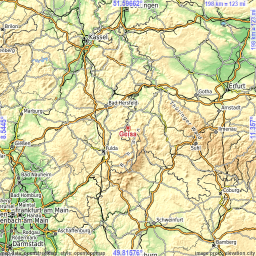
| Height | 6.19 km = 3.8 mi | 12.38 km = 7.7 mi | 198 km = 123 mi |
| ↑Max Latitude | 50.742467° | 50.770268° | 51.59662° |
| Latitude at center | 50.71465° | 50.71465° | 50.71465° |
| ↓Min Latitude | 50.686816° | 50.658966° | 49.81576° |
| ← Min Longitude | 9.906805° | 9.862859° | 8.5445° |
| Longitude center | 9.95075° | 9.95075° | 9.95075° |
| →Max Longitude | 9.994695° | 10.038641° | 11.357° |
Nearby cities:
Cities around Geisa sort by population:
• Hünfeld elevation 277 m
13.5 km,  253°
253°
• Eiterfeld 343 m
12.1 km,  298°
298°
• Schenklengsfeld 323 m
13.4 km,  328°
328°
• Tann 385 m
9.5 km,  147°
147°
• Philippsthal 234 m
14.5 km,  16°
16°
• Unterbreizbach 236 m
11.6 km,  11°
11°
• Vacha 237 m
13.5 km, 21°
• Dermbach 370 m
11.8 km,  90°
90°
• Rasdorf 333 m
3.6 km,  273°
273°
• Buttlar 260 m
4.8 km,  1°
1°
• Völkershausen 304 m
11.8 km,  36°
36°
• Schleid 335 m
2 km, 145°
Multilingual:
 En español:
Geisa elevación 293 m.
 En France:
Geisa élévation 293 m.
 Auf Deutsch:
Stadtgeis, Stadt-Geis höhe über dem Meeresspiegel ist 293 m.

Sources and notes:
- [note 1] Map square and city borders are not equal. Map elevation data is calculated only from area inside that square.
- [src 1] Elevation data from geonames database provided with same terms of usage.
- [src 2] The elevation map of Geisa is generated using elevation data from NASA's 3 arcsec (90m) resolution SRTM data.
- [src 3] Base (background) map © OpenStreetMap contributors tiles are generated by Geofabrik and OpenTopoMap.
Copyright & License:
This Geisa Elevation Map is licensed under CC BY-SA. You may reuse any part from this page, if you give a proper credit by linking to this URL:
 More info on terms of use page.