Schleid elevation
Schleid (Thuringia), Germany elevation is 335 meters and Schleid elevation in feet is 1099 ft above sea level [src 1]. Schleid is a seat of a fourth-order administrative division (feature code) with elevation that is 77 meters (253 ft) bigger than average city elevation in Germany.
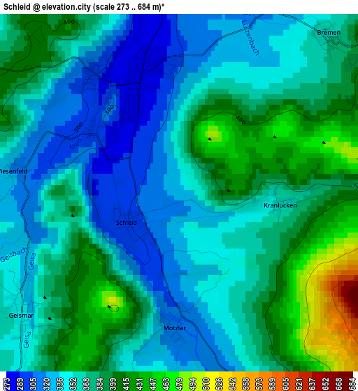
Below is the Elevation map of Schleid, which displays elevation range with different colors. Scale of the first map is from 273 to 684 m (896 to 2244 ft) with average elevation of 368.4 meters (=1209 ft) [note 1]
These maps also provides idea of topography and contour of this city, they are displayed at different zoom levels. More info about maps, scale and edge coordinates you can find below images.
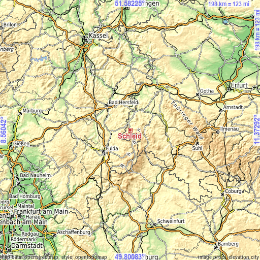
| \ | Map #1 | Topo.Map |
| Scale [m] | 273..684 m | × |
| Scale [ft] | 896..2244 ft | × |
| Average | 368.4 m = 1209 ft | × |
| Width | 6.19 km = 3.8 mi | 198.1 km = 123.1 mi |
| Height | 6.19 km = 3.8 mi | 198.1 km = 123.1 mi |
| ↑Max Latitude | 50.727826° | 51.58225° |
| Latitude at center | 50.7° | 50.7° |
| ↓Min Latitude | 50.672158° | 49.80083° |
| ← Min Longitude | 9.922725° | 8.56042° |
| Longitude center | 9.96667° | 9.96667° |
| →Max Longitude | 10.010615° | 11.37292° |
Nearby cities:
Cities around Schleid sort by population:
• Hünfeld elevation 277 m
14.2 km,  260°
260°
• Eiterfeld 343 m
13.9 km,  302°
302°
• Hilders 450 m
14.5 km,  169°
169°
• Tann 385 m
7.5 km,  147°
147°
• Unterbreizbach 236 m
13 km,  5°
5°
• Vacha 237 m
14.7 km,  15°
15°
• Geisa 293 m
2 km,  325°
325°
• Dermbach 370 m
10.8 km,  81°
81°
• Rasdorf 333 m
5 km,  291°
291°
• Buttlar 260 m
6.5 km,  351°
351°
• Völkershausen 304 m
12.6 km,  27°
27°
• Kaltenwestheim 501 m
14.6 km,  133°
133°
Multilingual:
 En español:
Schleid elevación 335 m.
 En France:
Schleid élévation 335 m.


Sources and notes:
- [note 1] Map square and city borders are not equal. Map elevation data is calculated only from area inside that square.
- [src 1] Elevation data from geonames database provided with same terms of usage.
- [src 2] The elevation map of Schleid is generated using elevation data from NASA's 3 arcsec (90m) resolution SRTM data.
- [src 3] Base (background) map © OpenStreetMap contributors tiles are generated by Geofabrik and OpenTopoMap.
Copyright & License:
This Schleid Elevation Map is licensed under CC BY-SA. You may reuse any part from this page, if you give a proper credit by linking to this URL:
 More info on terms of use page.