Koblenz elevation
Koblenz (Rheinland-Pfalz), Germany elevation is 75 meters and Koblenz elevation in feet is 246 ft above sea level [src 1]. Koblenz is a seat of a third-order administrative division (feature code) with elevation that is 183 meters (600 ft) smaller than average city elevation in Germany.
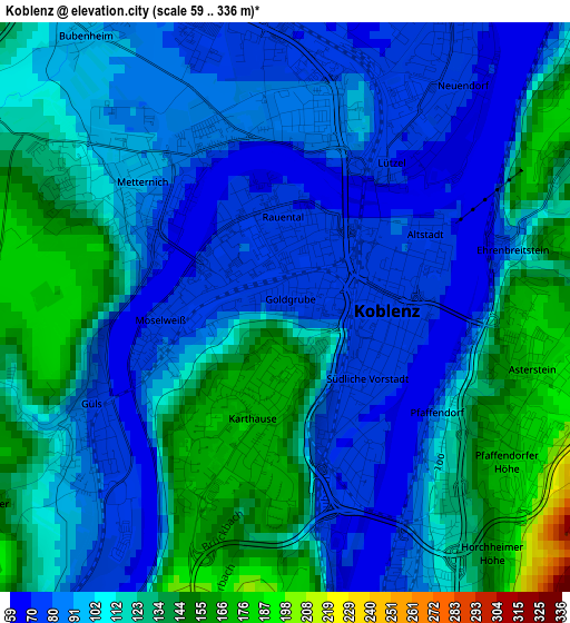
Below is the Elevation map of Koblenz, which displays elevation range with different colors. Scale of the first map is from 59 to 336 m (194 to 1102 ft) with average elevation of 108.4 meters (=356 ft) [note 1]
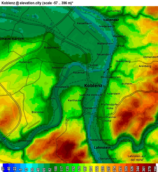
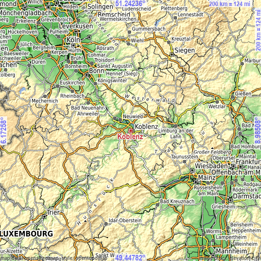
These maps also provides idea of topography and contour of this city, they are displayed at different zoom levels. More info about maps, scale and edge coordinates you can find below images.
| \ | Map #1 | Map #2 | Topo.Map |
| Scale [m] | 59..336 m | -57..396 m | × |
| Scale [ft] | 194..1102 ft | -187..1299 ft | × |
| Average | 108.4 m = 356 ft | 156.1 m = 512 ft | × |
| Width | 6.24 km = 3.9 mi | 12.47 km = 7.7 mi | 199.5 km = 124 mi |
| Height | 6.24 km = 3.9 mi | 12.47 km = 7.7 mi | 199.5 km = 124 mi |
| ↑Max Latitude | 50.381601° | 50.409615° | 51.24236° |
| Latitude at center | 50.35357° | 50.35357° | 50.35357° |
| ↓Min Latitude | 50.325522° | 50.297458° | 49.44782° |
| ← Min Longitude | 7.534885° | 7.490939° | 6.17258° |
| Longitude center | 7.57883° | 7.57883° | 7.57883° |
| →Max Longitude | 7.622775° | 7.666721° | 8.98508° |
Nearby cities:
Cities around Koblenz sort by population:
• Lahnstein elevation 134 m
6.5 km,  155°
155°
• Bendorf 96 m
7.7 km,  0°
0°
• Mülheim-Kärlich 92 m
6.7 km,  301°
301°
• Vallendar 168 m
5.7 km,  34°
34°
• Urbar 162 m
5.1 km,  49°
49°
• Sankt Sebastian 71 m
6.5 km,  349°
349°
• Winningen 100 m
6 km,  227°
227°
• Weitersburg 186 m
7.2 km,  12°
12°
• Kaltenengers 67 m
7.3 km,  343°
343°
• Simmern 283 m
7.8 km,  59°
59°
• Niederwerth 75 m
5.8 km, 27°
• Fachbach 186 m
7.7 km,  106°
106°
Multilingual:
 En español:
Coblenza elevación 75 m.
 En France:
Coblence élévation 75 m.


Sources and notes:
- [note 1] Map square and city borders are not equal. Map elevation data is calculated only from area inside that square.
- [src 1] Elevation data from geonames database provided with same terms of usage.
- [src 2] The elevation map of Koblenz is generated using elevation data from NASA's 3 arcsec (90m) resolution SRTM data.
- [src 3] Base (background) map © OpenStreetMap contributors tiles are generated by Geofabrik and OpenTopoMap.
Copyright & License:
This Koblenz Elevation Map is licensed under CC BY-SA. You may reuse any part from this page, if you give a proper credit by linking to this URL:
 More info on terms of use page.