Lahnstein elevation
Lahnstein (Rheinland-Pfalz), Germany elevation is 134 meters and Lahnstein elevation in feet is 440 ft above sea level [src 1]. Lahnstein is a populated place (feature code) with elevation that is 124 meters (407 ft) smaller than average city elevation in Germany.
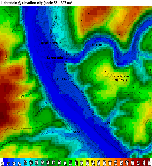
Below is the Elevation map of Lahnstein, which displays elevation range with different colors. Scale of the first map is from 58 to 397 m (190 to 1302 ft) with average elevation of 172.8 meters (=567 ft) [note 1]
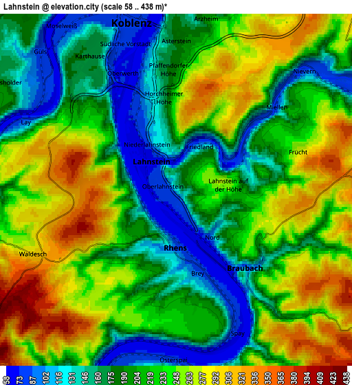
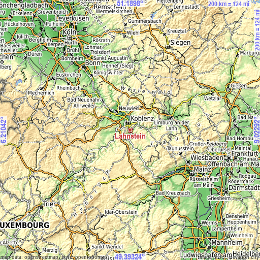
These maps also provides idea of topography and contour of this city, they are displayed at different zoom levels. More info about maps, scale and edge coordinates you can find below images.
| \ | Map #1 | Map #2 | Topo.Map |
| Scale [m] | 58..397 m | 58..438 m | × |
| Scale [ft] | 190..1302 ft | 190..1437 ft | × |
| Average | 172.8 m = 567 ft | 217.7 m = 714 ft | × |
| Width | 6.24 km = 3.9 mi | 12.48 km = 7.8 mi | 199.8 km = 124.1 mi |
| Height | 6.24 km = 3.9 mi | 12.48 km = 7.8 mi | 199.7 km = 124.1 mi |
| ↑Max Latitude | 50.328063° | 50.356109° | 51.1898° |
| Latitude at center | 50.3° | 50.3° | 50.3° |
| ↓Min Latitude | 50.271921° | 50.243825° | 49.39324° |
| ← Min Longitude | 7.572725° | 7.528779° | 6.21042° |
| Longitude center | 7.61667° | 7.61667° | 7.61667° |
| →Max Longitude | 7.660615° | 7.704561° | 9.02292° |
Nearby cities:
Cities around Lahnstein sort by population:
• Koblenz elevation 75 m
6.5 km,  335°
335°
• Boppard 80 m
7.9 km,  193°
193°
• Bad Ems 86 m
7.9 km,  60°
60°
• Braubach 70 m
3.6 km,  145°
145°
• Urbar 162 m
9.3 km,  7°
7°
• Rhens 80 m
2.1 km,  178°
178°
• Winningen 100 m
7.3 km,  284°
284°
• Spay 74 m
5.1 km, 153°
• Kamp-Bornhofen 89 m
8.6 km, 176°
• Brey 93 m
3.1 km,  167°
167°
• Osterspai 87 m
6.2 km, 182°
• Fachbach 186 m
6 km,  51°
51°
Multilingual:
 En español:
Lahnstein elevación 134 m.
 En France:
Lahnstein élévation 134 m.
 Auf Deutsch:
Lahnstein höhe über dem Meeresspiegel ist 134 m.

Sources and notes:
- [note 1] Map square and city borders are not equal. Map elevation data is calculated only from area inside that square.
- [src 1] Elevation data from geonames database provided with same terms of usage.
- [src 2] The elevation map of Lahnstein is generated using elevation data from NASA's 3 arcsec (90m) resolution SRTM data.
- [src 3] Base (background) map © OpenStreetMap contributors tiles are generated by Geofabrik and OpenTopoMap.
Copyright & License:
This Lahnstein Elevation Map is licensed under CC BY-SA. You may reuse any part from this page, if you give a proper credit by linking to this URL:
 More info on terms of use page.